
![]()
|
|
|
Table of Contents
Central Asia
Major Geographic Qualities
| ||||||||||||||||||||||||||||||||||||||||||||||||||||||||||||||||||||||||||||||||||||||||||||||||||||||||||||||||||||||||||||||||||||||||||||||||||||||||||||||||||||||||||||||||||||||||||||||||||||||||||||||||||||||||||||||||||||||||||||||||||||||||||||||||||||||||||||||||||||||||||||||||||||||||||||||||||||||||||||||||||||
|
|
China |
Hong Kong |
Japan |
Korea, North |
Korea, South |
Macau |
Taiwan |
|
167 years |
205 years |
>1000 years |
135 years |
135 years |
93.5 years |
360 years |
|
|
0.48 |
0.18 |
-0.19 |
0.53 |
0.26 |
0.44 |
0.11 |
|
|
[no current figures available for Tibet] |
|||||||

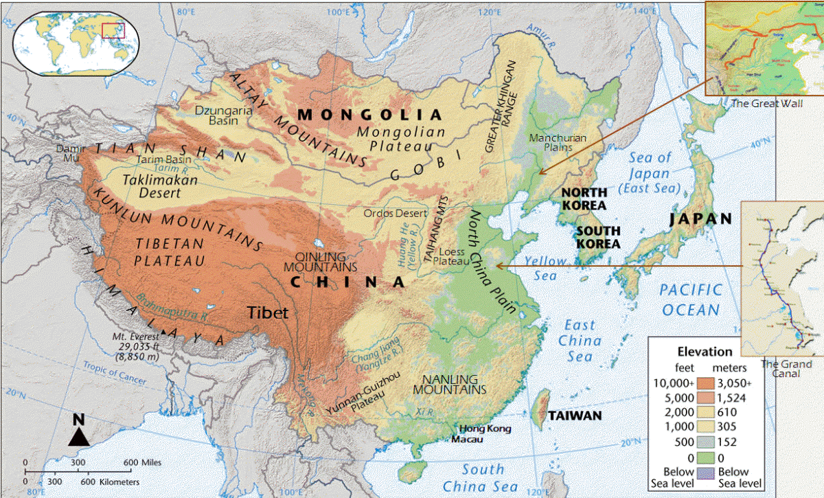
2. Only small areas of land are arable and most of the population lives there. China: Only 10% of the land is arable and 80% of the population lives on this land Distribution: western 2/3s is sparsely populated (minorities) … Japan: 60% of people live on only 3% of the land and most of the population is distributed along the narrow coastal plains … South Korea: 70% of the land is mountainous with population concentrated in lowland areas and coasts … North Korea: 19% of land is arable and is home to majority of population … Taiwan: Eastern two-thirds mostly rugged mountains and flat to gently rolling plains in west, with the population concentrated in the latter
3. urbanization: East Asia was one of the earliest urbanized areas but the region was overwhelmingly rural until the end of World War II. The oldest cities were fortified, with narrow alleyways and houses built around courtyards. The colonial period changed the urban form, emphasizing coastal cities. South Korea is noted for urban primacy (concentration of urban population in a single city). Japan displays a pattern of superconurbation (an extended urban area, typically consisting of several towns merging with the suburbs of one or more cities into a megalopolis, a huge zone of coalesced metropolitan areas)
Percent of Population that is Urban
|
China |
Hong Kong |
Japan |
Korea, North |
Korea, South |
Macau |
Taiwan |
|
57.9 |
100 |
94.1 |
61 |
81.7 |
99.3 |
77.5 |
|
[no current figures available for Tibet] |
||||||
Urbanization in East Asia: Visualizing urban expansion (Scroll to the bottom and press Start.)
a. Urbanization is driven by three factors: population growth, rural to urban migration and the reclassification of rural areas into urban areas. It is associated with higher levels of development and it has been underway in most of the world for a long time. What makes East Asia unique is the extremely rapid pace at which urbanization is proceeding. The rate of urbanization in Asia is greater than that in any other region of the world, and the highest growth rates are found in the poorest and least urbanized countries.
b. The growth in both the number and the size of the region’s megacities (agglomerations with a population in excess of 10 million people) continues to be an important regional and global trend. However, most of the region’s urban population is located in small and medium-sized towns and cities, which are in large part the source of higher growth rates. Most of East Asia’s population is still non-urban, meaning the region will likely face decades of further urbanization.
East Asia’s changing urban landscape (World Bank report)
c. There are a number of potential problems associated with urbanization.
i. water and air pollution
ii. congestion
iii. a lack of resilience to disasters
iv. needs of current and future older populations
v. lack of access to security of tenure, structural quality and durability of dwelling, law enforcement, safe water, sanitation facilities, sufficient energy and sufficient living area
vi. enormous inequalities at the urban level
vii. lack of or poor government planning
Asia’s urbanization just beginning
Urbanization trends in Asia (UN ESCAP fact sheet)
A new urban landscape in East Asia (Institute of Physic’s journal Environmental Research Letters)

1. China has the world’s fastest-growing economy, increasing 10% annually for years. This is in large part because China is the world’s largest manufacturer and exporter of goods. China has also created popular Special Economic Zones characterized by investor incentives, low taxes, eased import and export regulations, simplified land leases, permitted hiring of contract labor, and permission to sell products in foreign markets and in China (with certain restrictions), although their location was a prime consideration. But China isn’t alone in its growth.
China’s ascent over the past half-century has been remarkable, producing an almost unprecedented decline in poverty. Even so, the country’s economic model has been familiar: investing in physical capital and education to become more productive and lure residents of rural areas to cities where they work in factories. In the past, England, Germany, the US, Japan and South Korea all followed the same model. So did the Soviet Union, after World War II. It’s the path of economic development. To continue growing rapidly, though, China needs to make the next transition, from sweatshop economy to innovation economy. This transition has often proved difficult elsewhere. Once a country has turned itself into an export factory, it can’t keep growing by repeating what it’s already done. It can’t move a worker from an inefficient farm to a modern factory more than once. It can’t even keep its industrial might forever.
As a country industrializes, workers begin demanding their share of the bounty, as has started happening in China, and some factories start moving to poorer countries. Eventually, a rising economy needs to take two crucial steps: manufacture goods that aren’t just cheaper than the competition, but better; and create a thriving domestic market, so that its own consumers can pick up the slack when exports inevitably slow. These steps go hand in hand. Big consumer markets become laboratories where companies know that innovations will be tested and the successful ones richly rewarded. China’s economic problems stem from not having taken those steps. Its leaders have instead doubled down on the same strategies that worked in past decades, like the construction of more apartment buildings and factories. It’s not working.
Why Is China’s Economy Stumbling? (2023)
2. Japan, of course, has been a major economic power for some time. South Korea has modern factories, intensive and increasingly mechanized agriculture, and extensive trade with the US, Japan and Western Europe. Seoul is the urban-industrial center of the country, specializing in textiles, clothing, footwear and electronic goods. Taiwan has a dynamic capitalist economy, a substantial trade surplus and foreign reserves that are the world's third largest. Taiwan’s exports have provided the primary impetus for industrialization. Currently, agriculture contributes less than 2% to GDP (down from 32% in 1952) and the country has begun privatizing some large government-owned banks and industrial firms. China has overtaken the US to become Taiwan's largest export market. China has used its newfound wealth to invest around the world. Taiwan is a major investor throughout Southeast Asia.
3. The Jakota Triangle, consisting of Japan, South Korea and Taiwan, lies at the vanguard of Pacific Rim development. The Triangle is characterized by great cities, the enormous consumption of raw materials, state-of-the-art industries, voluminous exports, global links, trade surpluses and rapid development. But there are challenges as well, including social problems, political uncertainties and economic vulnerabilities.

4. The region’s fast economic growth has led to dramatic social changes. As a result of growth, wages have increased rapidly, giving Asian workers a better standard of living. Not all changes have been positive, though. Rapid economic growth has caused a number of social, environmental and economic problems. Growth in the cities has impoverished rural workers, who must migrate to congested urban areas to find jobs. Industrial activity has put stress on the region’s energy and transportation systems and degraded air, water and soil quality. Industrial growth also has major implications for global climate change, as China is the world’s largest producer of carbon dioxide emissions. Both South Korea and Taiwan are vulnerable to global market fluctuations, and both have experienced savage competition for land use.
5. Growth has not been experienced evenly throughout the region, or even within individual countries. For example, moving from the east to the west, China is less and less developed. Chinese economic reforms resulted in social and regional differentiation (where certain groups and/or portions of a country prosper while others fail) and most of China’s economic benefits have flowed to the booming coastal region and Beijing. China’s interior and northern portions have seen little economic expansion and Manchuria, for example, is now a rust belt.
6. Natural and mineral resources are unevenly distributed throughout East Asia. Forests are abundant but deforestation is a major problem. The people of East Asia make use of the sea for food. Water is used for hydroelectric power and as a means of transportation. China has large quantities of coal, iron ore and natural gas. Japan has reserves of lead, silver and coal. Despite the coal and natural gas in parts of the region, most of these countries have experienced serious energy shortages … a major problem given their fast economic growth.

7. The region is home to 16 of the largest 25 seaports in the world and 14 of the largest 25 container ports. Without this improved connectivity, the region's rapid expansion in trade volumes would not have been possible. However, internal transportation infrastructures are poorly developed in many areas. Given the mountainous geography of most of the region, building and maintaining roads is extremely expensive. Where present, rivers are often used as a means of internal transportation of people and goods.
8. East Asia countries have a huge impact on the global economy. East Asian economies are based primarily on manufacturing and trade and have a history of being a source of cheap labor, but the latter is starting to change.
9. BRICS is a group of major emerging economies - including China, Russia, India, Brazil and South Africa - seeking more political and economic influence in a global system dominated by the US and Europe. (The term BRICS was coined in 2001 by Goldman Sachs economist Jim O'Neill to describe fast-growing economies that he predicted would collectively dominate the global economy by 2050.) The BRICS nations encompass about 27% of the world's land surface and 42% of the global population. Since 2009, they have increasingly formed into a more cohesive geopolitical bloc, with their governments meeting annually at formal summits and coordinating multilateral policies. The group's focus includes economic cooperation and increasing multilateral trade and development. Bilateral relations among BRICS are conducted mainly on the basis of non-interference, equality and mutual benefit. The group has no clear political coherence except the desire to reshape the current global financial and governing system to one that is more open, more varied, less restrictive and less subject to American politics and the power of the dollar. The group has so far failed to deliver on its long-stated goal of establishing a BRICS currency to rival the hegemony of the US dollar. While BRICS nations may have unified in opposition to Western dominance, their individual goals differ. India, for example, is wary about the changing nature of the group from a geoeconomic one to a geopolitical one. Many observers say the group is all about symbolism but the enthusiasm of many developing countries to join BRICS reflects not only the appeal of China’s values-neutral globalization but also the failure of Western countries to build a more inclusive international order. Around 40 countries expressed an interest in joining BRICS prior to its August 2023 summit. During its annual summit, current members invited Saudi Arabia, the United Arab Emirates, Argentina, Egypt, Ethiopia and Iran to join. The expanded group will need to decide if BRICS will be a bloc of emerging economies seeking to promote their interests in a multi-polar world order or will adopt a more explicitly anti-West orientation, the latter of which is preferred by China and Russia.

1. The political history of this region revolves around the centrality of China. Between 219 BCE and 1912 CE, several different Chinese dynasties rose and fell, all of which roughly controlled the same geographic area. Perhaps one of the most significant periods in Chinese history occurred in 1644, with the collapse of the Ming Dynasty and the rise of the Ch'ing Dynasty. It was during the Ch'ing period that China's territory was extended to include much of Central Asia. The Manchus, architects of the Ch'ing Dynasty, were able to subdue the Mongols, and by the mid-1700s had established control over the entire eastern half of Central Asia, including Tibet. Never before had the Chinese Empire been so extensive or so powerful.

2. The Politburo Standing Committee (PSC) is a committee consisting of the top leadership of the Communist Party of China (CCP). Historically it has been composed of five to nine members. Its officially mandated purpose is to conduct policy discussions and make decisions on major issues when the Politburo, a larger decision-making body, is not in session. While the PSC in theory reports to the Politburo, which in turn reports to the larger Central Committee, in practice the PSC acts as the most powerful decision-making body in China, and its decisions de facto have the force of law. In modern times, the policies of the ruling Chinese Communist Party have been directed at economic development and modernization to benefit the world's largest population, and the reestablishment of China's position and identity as a world leader. China, with its large population, massive territory and an economy that has developed rapidly for decades, appears to be on the road to becoming a great power. China has a substantial nuclear arsenal, is a rising regional military power and is one of the five permanent members of the Security Council.
3. The Chinese government’s stance toward the democratically elected governments on Taiwan constitutes a major regional problem. Taiwan’s government increasingly claims the right to international autonomy, while the central Chinese government maintains its claim to be the sole legitimate state over all Chinese territory, including Taiwan. This has led to increasing tensions in recent years. The Chinese remain sensitive to any perceived challenges to their national sovereignty.
4. Japan: The imperial
institution, the most enduring institutional form in Japan's history, originated
with the rulers of the conquering tribe in early Japan. Their ruler became the
highest officer of the realm, the emperor. But real authority was soon
transferred to men who ruled in the name of the emperor, where it remained for
nearly all of Japanese history. This quiet devolution of political power from
the highest office to offices around or below the emperor reflected the Japanese
preference for evolutionary, rather than revolutionary, change and also the
value placed on political stability. Political change took place, while the
emperor remained the symbolic center of the realm, never ruling and never
overthrown, contributing to the preservation of Japanese culture embodied in the
imperial institution and its national mythology. The rise of the samurai
occurred during Japan's medieval period (12th to 16th centuries), which saw a
further devolution of political rule from court nobles to warrior families, most
notably a shogun who ruled in the emperor's name. The daimyo were
feudal military lords who possessed land and samurai retainers bound into
close, stratified domains in the provinces. Samurai values of personal
loyalty and service to the lord became a central cultural value preserved over
the centuries. Genroku culture (c. 1700) centered on urban commoners,
the merchants and artisans, no longer the courtiers or even the samurai.
Village Japan, with its mutually dependent communal society, became the model of
social closeness that remains idealized to this day.
became the
highest officer of the realm, the emperor. But real authority was soon
transferred to men who ruled in the name of the emperor, where it remained for
nearly all of Japanese history. This quiet devolution of political power from
the highest office to offices around or below the emperor reflected the Japanese
preference for evolutionary, rather than revolutionary, change and also the
value placed on political stability. Political change took place, while the
emperor remained the symbolic center of the realm, never ruling and never
overthrown, contributing to the preservation of Japanese culture embodied in the
imperial institution and its national mythology. The rise of the samurai
occurred during Japan's medieval period (12th to 16th centuries), which saw a
further devolution of political rule from court nobles to warrior families, most
notably a shogun who ruled in the emperor's name. The daimyo were
feudal military lords who possessed land and samurai retainers bound into
close, stratified domains in the provinces. Samurai values of personal
loyalty and service to the lord became a central cultural value preserved over
the centuries. Genroku culture (c. 1700) centered on urban commoners,
the merchants and artisans, no longer the courtiers or even the samurai.
Village Japan, with its mutually dependent communal society, became the model of
social closeness that remains idealized to this day.
The Quad, officially the Quadrilateral Security Dialogue, is a group of four countries: the United States, Australia, India, and Japan. Maritime cooperation among them began after the Indian Ocean tsunami of 2004. But today the countries - all democracies and vibrant economies - work on a far broader agenda, which includes tackling security, economic and health issues. Over the years, the Quad’s diplomacy has waxed and waned. It is a loose grouping rather than a formal alliance. Japan initially emphasized the democratic identity of the four nations, whereas India seemed more comfortable emphasizing functional cooperation. Australian leaders have been reluctant about creating the impression that the group is a formal alliance. As of 2021, leaders in all four countries have become more aligned in their shared concerns about China’s increasingly assertive behavior in the region and are more willing to define a constructive agenda of cooperation.
5. In modern times Korea has been the object of strategic rivalry among competing regional powers, including China, Russia and Japan. The hostility and potential for military conflict between the two heavily armed Korean states is a cause of great concern.
6. East Asia
b. Hong Kong Special Administrative Region (People's Republic of China)
c. Japan
d. Democratic People’s Republic of Korea (North)
e. Republic of Korea (South)
f. Macau Special Administrative Region (People's Republic of China)
g. Taiwan (Republic of China)
h. Tibet Autonomous Region / Xizang Autonomous Region (People’s Republic of China)

Political Resources on the Net
Google's Arts & Culture collection virtual world museum tours
Videographic: East Asia's maritime disputes (2:55)
The
People's Republic of China site covers several different levels of
information about China. It has links to issues such as China's position on
Tibet as well as news items. Some of the links appear to only take you to pages
that are in Chinese, but it is still a good source for a lot of information. |
Journey to China and explore the different regions of this ancient land. |
Travel to the forbidden city of Beijing, China. A comprehensive listing of
additional sites is on
The Beijing Page. |
Chinese Smog |
Take a tour of China, one of the major cultural hearths of the world and one
of the oldest cultural centers on earth. It is known for the philosophies of
Confucianism and
Taoism. China is famous for its
populated cities, its
raging rivers and its
Great Wall. |
A Timeline of Chinese inventions |
Timeline of Chinese history and dynasties |
China from above |
China’s cities |
The Road Ahead |
China: Inside the dragon |
How China is ruled: Communist Party |
What was China's one-child policy? |
Photos: Beijing and near-Beijing, 1900-1903 |
How China sees the world (Very interesting!) |
China’s Great Leap Backward |
China’s dangerous maritime game |
How China Sees the World and How We Should See China |
China’s Mistakes Can Be America’s Gain (09/26/22)
history and dynasties |
China from above |
China’s cities |
The Road Ahead |
China: Inside the dragon |
How China is ruled: Communist Party |
What was China's one-child policy? |
Photos: Beijing and near-Beijing, 1900-1903 |
How China sees the world (Very interesting!) |
China’s Great Leap Backward |
China’s dangerous maritime game |
How China Sees the World and How We Should See China |
China’s Mistakes Can Be America’s Gain (09/26/22)
China | Over the centuries, Shanghai, China has seen both peace time and war. It has been invaded and bombed and restored. Now it's one of the world's major financial centers, the core of China's political intrigues and the cradle of modern Chinese cinema and theater. | China’s birthrate has fallen so much that its population could soon begin to shrink.| The Exposure of China’s ‘Bought Wives’ | China is rebuilding a secretive base where it has long conducted underground nuclear weapons testing, satellite images reveal. | China accounts for a third of the world’s energy-related greenhouse gas emissions - more than North America, Central America, South America, Europe and Africa combined.
The construction of The Great Wall of China began in the 3rd century BCE when Emperor Qin Shi Huang ordered the building of a solid wall to protect the northwestern border of the empire from the attacks of nomadic people. The construction of the wall was challenging. The main problem was the lack of appropriate infrastructure: there were no roads and not enough water or food for 300,000 workers. It was also difficult to build such a large structure on the given terrain. The wall was designed to run along the mountain chain, rounding all the spurs and covering both high rises and deep gorges. This feature, along with its length, is what makes the Great Wall of China unique: it seamlessly blends in with the landscape. The first sections of the wall were made from mud; later the mud construction was replaced with stone slabs laid on top of each other. In order to bind these parts, as well as to control the growth of weeds in the joints of plates, the Chinese invented a unique sealer: a mixture of thick and sticky rice porridge combined with hydrated lime. This innovative technology created problems in southern China when entire crops of rice were exported by order of the Emperor. During its long history the wall repeatedly changed its appearance: some parts were destroyed, while others were rebuilt from scratch. All along the wall you can see protective vaults and guard towers, as well as fortresses at the main mountain passes. The Chinese say that the total length of the Great Wall, with all of its branches is 5,499 miles, although a recent archaeological survey concluded that the wall used to be much longer — 13,170 miles. | Rare vintage pictures of the Great Wall of China in the 1900s | virtual Great Wall of China
 Ethnic Clashes in China: Uighurs vs. Han Chinese |
Han Chinese in Tibet (Also, try some of the links at the bottom of the page.) |
‘Absolutely No Mercy’: Leaked
Files Expose How China Organized Mass Detentions of Muslims |
UN Says China May Have Committed ‘Crimes against Humanity’ in Xinjiang |
One Nation under Xi: How China’s Leader Is Remaking Its Identity |
Extreme China heat wave could lead to global chaos and food shortages. |
China may ban clothes that hurt people’s feelings. People are outraged. |
Blasting bullhorns and water cannons, Chinese ships wall off the sea. |
The crimes behind the seafood you eat |
China has invested close to $1 trillion for
influence abroad, often by paying for development projects. Xi Jinping is
rethinking the strategy, called the
Belt and Road Initiative.
|
China’s military is making risky moves and adding nuclear warheads. |
Far West China Blog |
Leaked files show the secret world of China’s hackers for hire.
Ethnic Clashes in China: Uighurs vs. Han Chinese |
Han Chinese in Tibet (Also, try some of the links at the bottom of the page.) |
‘Absolutely No Mercy’: Leaked
Files Expose How China Organized Mass Detentions of Muslims |
UN Says China May Have Committed ‘Crimes against Humanity’ in Xinjiang |
One Nation under Xi: How China’s Leader Is Remaking Its Identity |
Extreme China heat wave could lead to global chaos and food shortages. |
China may ban clothes that hurt people’s feelings. People are outraged. |
Blasting bullhorns and water cannons, Chinese ships wall off the sea. |
The crimes behind the seafood you eat |
China has invested close to $1 trillion for
influence abroad, often by paying for development projects. Xi Jinping is
rethinking the strategy, called the
Belt and Road Initiative.
|
China’s military is making risky moves and adding nuclear warheads. |
Far West China Blog |
Leaked files show the secret world of China’s hackers for hire.
Friends of the Earth (Hong Kong) is the site for an environmental group in Hong Kong. The Environmental Fact Sheet Web Page is compiled and published by the Friends of the Earth Hong Kong. This fact sheet has information about water pollution, air pollution, waste, and more. (Sometimes you can't get it in English!)
Hong Kong1 | Hong Kong 2 | Hong Kong 3 | The official YouTube channel for Discover Hong Kong | South China Morning Post | The death of an irreverent Hong Kong magazine | China says it must act to deter Hong Kong separatism. | “It is an official death sentence for Hong Kong:” China moves to pass national security law | Hong Kong’s Revolutionary Anthem Is a Challenge to China | Why Mainland Chinese Flocked to Hong Kong’s New Global Visa | In Hong Kong, China’s grip can feel like ‘death by a thousand cuts.’ | Hong Kong adopts sweeping security laws, bowing to Beijing.
Japan |
Take a tour of Japan, an island chain that has played a significant role in
world history. During World War II
Japan conquered massive pieces of Asia and today is one of the most
industrious and economically
prosperous countries in the world. |
Take a photographic tour of Japan and experience day-to-day life in this
East Asian nation. |
Take a virtual tour of Edo, Japan. Never heard of Edo? This is the ancient
name given to the city of
Tokyo,
Japan's largest city and now one of the most important in the modern
industrial world. |
Government of Japan's Environment Agency is the official government of Japan
web page on environmental issues. It contains links and information about the
state of Japan's environment as well as laws and regulations, policy,
organization, etc. One can get a sense of Japan's
philosophy with respect to the environment as well as programs in place to
improve it. |
Japanese History: A Chronological Outline |
Kume Island Guide (Okinawa) |
Photographing the Incredible Costumes of Japan's Supernatural Festivals |
Japan Unleashes a Robot Revolution |
The Most Bizarre, Entertaining History of Japan You'll Ever Watch (9:00) |
Tokyo Japan Cam |
Elderly people make up a third of Japan’s population – and it’s reshaping the
country. |
A 95-Square-Foot Tokyo Apartment: ‘I Wouldn’t Live Anywhere Else’ | The
Quadrilateral Security Dialogue (QSD), commonly known as
the Quad, is a strategic security dialogue between Australia, India, Japan
and the US that is maintained by talks between member countries. |
Japan's new births fall to record low in 2023 as demographic woes deepen.
one of the most
industrious and economically
prosperous countries in the world. |
Take a photographic tour of Japan and experience day-to-day life in this
East Asian nation. |
Take a virtual tour of Edo, Japan. Never heard of Edo? This is the ancient
name given to the city of
Tokyo,
Japan's largest city and now one of the most important in the modern
industrial world. |
Government of Japan's Environment Agency is the official government of Japan
web page on environmental issues. It contains links and information about the
state of Japan's environment as well as laws and regulations, policy,
organization, etc. One can get a sense of Japan's
philosophy with respect to the environment as well as programs in place to
improve it. |
Japanese History: A Chronological Outline |
Kume Island Guide (Okinawa) |
Photographing the Incredible Costumes of Japan's Supernatural Festivals |
Japan Unleashes a Robot Revolution |
The Most Bizarre, Entertaining History of Japan You'll Ever Watch (9:00) |
Tokyo Japan Cam |
Elderly people make up a third of Japan’s population – and it’s reshaping the
country. |
A 95-Square-Foot Tokyo Apartment: ‘I Wouldn’t Live Anywhere Else’ | The
Quadrilateral Security Dialogue (QSD), commonly known as
the Quad, is a strategic security dialogue between Australia, India, Japan
and the US that is maintained by talks between member countries. |
Japan's new births fall to record low in 2023 as demographic woes deepen.
1950: North Korea invades South Korea

Korean legend generally dates the beginning of its history around 2333 BCE. In the centuries that followed, the Korean peninsula changed hands numerous times. Following WWII, Koreans hoped for a unified peninsula but Cold War politics made that impossible. The peninsula was divided along the 38th parallel – its current division – with the US occupying the southern part and the Soviets occupying the northern part and supporting Kim Il-sung (whose family has ruled in North Korea since that time). The US and Soviets withdrew until 1950 when North Korea invaded South Korea and swiftly overran most of the country, beginning the Korean War. The US and China intervened on opposite sides in the first armed confrontation of the Cold War. Conflict ended in 1953, restoring the original boundaries between North and South Korea but it cost the lives of more than one million civilians and soldiers and almost every substantial building in North Korea was destroyed. Today, North Korea exists in almost total isolation, internet and much of the 21st century remain unknown, and millions live their lives in the shadow of an all-encompassing personality cult that intrudes on all aspects of daily life. | A timeline of Korean history | Obstacles to Korean re-unification
North Korea | North Korea’s growing economy … and America’s misconceptions about it | Meet Kim Jong Un | A remote corner of China wants access to the sea. The obstacle is North Korea. | Escape From North Korea | 20 crazy facts about North Korea | 20 things I learned while I was in North Korea (Warning: Good article but the language is really raw … Don’t read it if the language will offend you.) | National Geographic Explorer: Inside North Korea (50:15) | North Korea Revealed | Kim Jong-un’s daughter Is his likely successor. | Inside North Korea’s Forced-Labor Program
South Korea | South Korea threatens North it could launch 'self-defensive' nuke (0:48) | Korea.net | Anti-graft law stirs up wariness over South Koreans bearing gifts | Visit Korea | Warning that Korean peninsula could become new quake zone after series of tremors in the South | Culture | Informal settlements in South Korea | This country wanted a 69-hour workweek. Millennials and Generation Z had other ideas. | The Real Reason South Koreans Aren’t Having Babies | Is South Korea Disappearing? | For New Moms in Seoul, 3 Weeks of Pampering and Sleep at a Joriwon
Macau | Macau, also spelled Macao, is an autonomous territory on the western side of the Pearl River Delta, China. Macau is bordered by the city of Zhuhai in Mainland China to the north and the Pearl River Estuary to the east and south. Hong Kong lies about 40 miles to the east across the Delta. With an estimated population of around 652,500 living in an area of 11.8 square miles, it is the most densely populated region in the world. It also generates more revenue from gambling than anywhere else on the planet. | Top things to do in Macau | Macau’s temples and churches

Taiwan | Take a virtual trip to Taiwan, an island nation roughly the size of Maryland and the focus of much tension between China and the US. Modern Taiwan was formed in 1949 when nationalist forces, defeated by the communists in mainland China, sought refuge on the island. As a result, both, the Taiwanese and Mandarin languages are spoken on the island. | Jialeshuei: A Virtual Tour of Taiwan's Bizarre Southeastern Coastline | Maps: Tracking Tensions Between China and Taiwan (08/2022) | The Coming War Over Taiwan | China and Taiwan: A Torrid Back Story | Taiwan Likes Its Democracy Loud and Proud: The 2024 Elections | How Taiwan’s Tallest Skyscraper Withstands Earthquakes
Ministry of Foreign Affairs: Republic of China is the web site for the Government Information Office for the Republic of China (Taiwan). It contains links (in several languages) to information about Taiwan, including history and current issues (such as relations with the People's Republic of China - which it calls Mainland Affairs). Other links include culture, environment, and news. | How China Could Choke Taiwan | The fate of the world economy may depend on what happens to a company most Americans have never heard of.
 Tibet |
Take a virtual field trip to Tibet, now an autonomous region of China known
as Xizang. | A source of much discussion in recent decades is the
Tibetan movement for independence. From 1642 until the 1950s (except for
1705 to 1750), the
Dalai Lama or his regent was the head the Tibetan government (Ganden
Phodrang), which governed the
Tibetan plateau from
Lhasa with varying degrees of autonomy. In 1949, China launched a
massive invasion of
Tibet. Pursued by the Chinese army, the 23-year-old
Dalai Lama (the 14th) escaped over the
Zsagola pass, ultimately finding refuge in India. |
View images from Tibetan society. (Click on the pictures on that page
and each will take you to a gallery of related pictures.) |
The Government of Tibet in Exile |
China signals policy shift on Dalai Lama |
Seven Years in Tibet (1997, 139 min) provides a shallow but pretty good
look at Lhasa and the young Dalai Lama prior to the Chinese communist
invasion. |
How to Visit Tibet Safely, Easily and Ethically |
Glimpses of a Changing Tibet
Tibet |
Take a virtual field trip to Tibet, now an autonomous region of China known
as Xizang. | A source of much discussion in recent decades is the
Tibetan movement for independence. From 1642 until the 1950s (except for
1705 to 1750), the
Dalai Lama or his regent was the head the Tibetan government (Ganden
Phodrang), which governed the
Tibetan plateau from
Lhasa with varying degrees of autonomy. In 1949, China launched a
massive invasion of
Tibet. Pursued by the Chinese army, the 23-year-old
Dalai Lama (the 14th) escaped over the
Zsagola pass, ultimately finding refuge in India. |
View images from Tibetan society. (Click on the pictures on that page
and each will take you to a gallery of related pictures.) |
The Government of Tibet in Exile |
China signals policy shift on Dalai Lama |
Seven Years in Tibet (1997, 139 min) provides a shallow but pretty good
look at Lhasa and the young Dalai Lama prior to the Chinese communist
invasion. |
How to Visit Tibet Safely, Easily and Ethically |
Glimpses of a Changing Tibet
There are lots of pictures so it may take a minute for the page to open!
![]()


1. well defined in physiographic terms
2. world’s second largest population cluster
3. significant demographic problems
4. low-income economies
5. population concentrated in villages, with subsistence agriculture
6. strong cultural regionalism
7. boundary conflicts

1. physiographic diversity
2. The Maldives, an island chain southwest of India, is experiencing first-hand the effects of rising sea levels. With 80% of the land area of The Maldives at less than 3 feet above sea level, rising sea levels are posing a serious threat to the islands and their inhabitants.
3. monsoons
a. widespread flooding
b. property damage
c. destruction to agricultural lands
d. damage to transportation infrastructure

e. homelessness
f. disease and malnutrition
g. serious injury and death
4. In geological terms, South Asia is a recent addition to the continental landmass of Asia. The greater part of what is now South Asia broke away from the coast of Africa about 100 million years ago and drifted slowly on a separate geological plate for over 70 million years until it collided with the southern edge of Asia. The slow but relentless impact crumpled the sedimentary rocks on the south coast of Asia into a series of lofty mountain ranges and lifted the Tibetan Plateau more than 3.1 miles into the air. The Himalayas, which stand at the center of South Asia's mountain rim, are still rising (at a rate of about 9.8 inches per century) as a result of this geological event.
Continental Collision: India-Asia (On the site, click the play arrow on the small movie to the right. If you get a pop-up, click on the play arrow on the pop-up.)
5. Not surprisingly, the principal physiographic zones of South Asia also reflect this major geological event.
a. The Himalaya, Karakorum and Hindu Kush mountain ranges in the north separate the South Asian subcontinent from the rest of Asia. The Himalayas, the highest mountains in the world, extend 1,500 miles west from the Brahmaputra River to the Karakorum, a mountain range that extends 300 miles and lies between the Indus River to its east and the Yarkand River to its west. The Hindu Kush, the world's second highest range, extends 500 miles west and south of the Yarkand River.
b. To the south of the mountain ranges is a 200-mile-wide belt of river lowlands that divides the northern and southern zones, the Indo-Gangetic plain. The plain is a broad strip of low, relatively flat land lying between the Himalaya Mountains to the north and the Narmada and Mahanadi Rivers to the south. This alluvial plain has been created by the Indus, Ganges and Brahmaputra Rivers and their many tributaries as they flow from the Himalayas to the sea.
c. To the south of the plain is the southern peninsular plateau - the Deccan plateau - a relatively flat highland area that lies between the Western Ghat Mountains and the Eastern Ghat Mountains. The mountains separate the plateau from the coastline and meet in the south at the tip of the triangular-shaped peninsula known as Peninsular India. Coastal plains lie between the Arabian Sea and the Western Ghat mountain range and between the Bay of Bengal and the Eastern Ghat Mountains.

d. Far out into the Bay of Bengal are the Andaman and Nicobar Islands, both belonging to India but physiographically an extension of the Sumatran ranges of Southeast Asia. About 400 miles to the southwest of India are the Maldives, an independent state of 1190 tiny islands, only 200 of which are inhabited, grouped into 26 atolls.

1. The Indus River is a cultural hearth where early culture emerged and developed. It is believed that the roots of South Asian culture originated from the Indus Valley civilization in what is now Pakistan more than 5,000 years ago. By 800 BCE a new urban focus had emerged in the middle Ganges Valley, the area in which the Buddhist faith was later organized.
2. Arts and trade routes emerged from isolated tribes and villages to towns and beyond.
3. culturally fragmented
4. religious and linguistic diversity
5. religious patterns: Despite the success of
Buddhism, especially abroad, the region has been predominantly shaped by the
Hindu faith. However, there is enormous complexity when examining the
religious expression of contemporary South Asia. Not only are there other
religions to be found here, but Hinduism itself is a geographically complicated
religion with different aspects of the faith, such as the worship of specific
deities, varying greatly between places. Pakistan and Bangladesh are
overwhelmingly
Islamic. Other major religions, such as Buddhism,
Sikhism,
Jainism and Christianity, are found in various locations throughout the
subcontinent.
a. Islam: predominant in Pakistan and Bangladesh, swept through central India from the 8th through the 10th centuries CE
b. Hinduism: predominant in India, emerged from the beliefs and practices brought to India by the Indo-Europeans (Aryans) in the 6th century BCE, world’s oldest religion, not just a religion but an intricate web of religious, philosophical, social, economic and artistic elements with no common creed, single doctrine, direct divine revelation or rigid narrow moral code
c. Buddhism: predominant in Sri Lanka, born of discontent, made the state religion of India in the 3rd century BCE, adherents objected to harsher features of Hinduism, focuses on knowledge (especially self-knowledge), the elimination of worldly desires and a determination not to hurt or kill people or animals, practically wiped out as a religion with the arrival of Islam in the 8th century
d. Sikhism: thrives in northern India, religion created to unite warring Hindus and Muslims into a single faith
e. This region is the site of recent and emerging democracies, a high degree of religious pluralism, large Muslim populations, and several well-organized terrorist groups, so it’s not surprising that religious conflict often occurs – Buddhists vs. Muslims, Hindus vs. Muslims, between Muslim sects and discrimination over the caste system, to name a few.

1. The population of South Asia is unevenly distributed with very densely populated areas and very sparsely populated areas, due in large part to the region’s geography. Generally we see ribbon-like extensions of dense population clustered near rivers where the majority of people are farmers. India has an arithmetic density of 904 people per square mile but a physiologic density of 1,615 per square mile (US=415/sq mi). Bangladesh has 2,644/sq mile. All of the region’s countries remain predominately rural. The regional rate of urbanization is 36.8%. (High is Maldives at 45.8%, low is Nepal at 18.9%.)
Demographic vocabulary definitions
The Asia-Pacific Region Is Experiencing Low Fertility and Population Aging
2. No other region of the world has such serious population problems as does South Asia and no other area of comparable size and cultural attainments are as poor. Out of the ten most populous countries in the world, South Asia has three: India, Pakistan and Bangladesh. These numbers are certainly a cause for concern, but even more disturbing is the fact that they continue to escalate.
3. Population pressures began to build in the region during the later decades of British rule. Improvements in public health measures, medical care, agricultural productivity, the establishment of law and order and the reduction in the frequency and severity of famine, brought about a decline in the mortality rate and life expectancy rose.
Fertility remained high, as the traditional preference for larger families was the rule. This created a widening gap between fertility and mortality, and a consequent rise in the rate of natural increase. Only in the last decade has the rate of increase begun to slow. Presently, the region’s population is growing at a rate of 1.3% annually. (High is Pakistan at 2.0%, low is Sri Lanka at 0.5%.) Even though numbers are declining, all countries in the region still have a positive rate of natural population change.

4. Social change and economic development, proceeding unevenly throughout the subcontinent, have been hampered by the enormous growth in population since independence. The demographic structure of South Asian nations is represented by an age-sex pyramid which clearly shows that the youthful age groups are very large. Nearly 40% of the South Asian population is below 15 years of age. Such age structures are particularly troubling, as the provision of services, schools, food, hospitals and housing for the young must consume a large part of national expenditures. The bulk of population growth in Asia over the next three and a half decades will be in South Asia, a result not of high birth rates but of the large number of people in the childbearing ages, itself the product of past higher levels of fertility. This will lead to increased population density, a high dependency ratio and strong demand for employment — and these factors will put great pressure on development.
What will South Asia look like in 2025?
5. Demographic Transition Model (illustrated above right)
Demographic transition (DT) refers to the transition from high birth and death rates to lower birth and death rates as a country or region develops from a pre-industrial to an industrialized economic system. The existence of some kind of demographic transition is widely accepted because of the well-established historical correlation linking dropping fertility to social and economic development but there is debate over whether industrialization and higher incomes lead to lower populations, or whether lower populations lead to industrialization and higher incomes. South Asian countries are in the third stage, although some are nearer the beginning while others are nearer the end.
a. stage 1: high birth rate + high death rate = low growth rate
b. stage 2: high birth rate + decreasing death rate = higher growth rate and population explosion
c. stage 3: decreasing birth rate + level death rate = decreasing growth rate
d. stage 4: low birth rate + low death rate = low growth rate
e. As you can see from the illustration above, some theorists have added a 5th stage.
For a closer look at the DTM (Use links at bottom of each section.)
Demographic Dividend: The Youth Factor (Pakistan)
1. South Asia has few natural resources and competition over those increasingly scarce resources is growing. It is estimated that 22 of 32 Indian cities face daily water shortages. In Nepal’s capital, Kathmandu, many local residents have grown accustomed to waiting in queues for hours to obtain drinking water from the city’s ancient, stone waterspouts. In Karachi, Pakistan, electricity and water shortages have led to protests and city-wide unrest. This lack of and competition over resources represents a very real threat to regional security.
2. South Asia is a source of considerable interest these days because its economic growth performance has considerably outperformed that of other regions of the world. South Asia has experienced a long period of robust economic growth and it has been among the fastest-growing in the world. This strong growth has translated into declining poverty and impressive improvements in human development. But poverty in the region remains high. The subcontinent has a small elite of very wealthy people and a large and growing middle class. It also has almost one half of the world’s poor even though it has only 20% of the world’s population. More than 200 million people live in slums, and half a billion people go without electricity. Most suffer from malnutrition and poor health.

3. India’s first prime minister wanted the government to have control over the most important sectors of the economy. The Indian government imposed numerous regulations on both native and foreign businesses, an act that led to the creation of large, state-owned monopolistic companies. A growing middle class has developed, which has created a huge internal market that has spurred industrial production. But, over time the economy has become overregulated, increasingly inefficient, hostile to foreign trade and investment, and riddled with corruption.
Facing a major financial crisis in 1991, the Indian government sped up a shift to a capitalistic market economy. Since then, the economy has begun to grow at a more rapid rate, but the transition is being resisted by those who favor the old system. The cultural resistance to change hinders any economic advancement for the majority of people. Moreover, many Indians are ill-equipped for world competition. For example, only 65.5% of men and 38% of women are literate.

4. Pakistan has followed more capitalistic, market-oriented economic policies. Pakistan’s government attempted to control economic development through a series of five-year plans. However, the country frequently was unable to achieve its goals because of governmental instability, changing priorities and high military spending. Pakistan’s current government faces serious economic problems: a high foreign debt, foreign reserves that are too low to purchase needed imports, imports that are twice as much as its exports, and difficulty in collecting taxes. Some have argued that Pakistan’s current aggressive stance on Kashmir has been engineered by its prime minister to distract his people from Pakistan’s current economic crisis. Only 50% of men and 25% of women in Pakistan can read and write.

5. Bangladesh has followed capitalistic, market-oriented economic policies. Less developed and poorer than Pakistan, Bangladesh has economic problems: (a) frequent natural disasters such as typhoons hit this low-lying country and bring devastating floods, (b) high population growth in an already densely populated country, (c) government instability, inefficiency, and corruption and (d) heavy reliance on foreign aid, which distorts markets and causes corruption. Bangladesh attempted to reform its economic institutions and policies in the 1990s. The government has begun to encourage foreign trade and investment, and the economy has achieved annual growth rates of around 5% for the past decade. But literacy rates in Bangladesh are very low. Only 49% of men and 26% of women can read and write.
6. Although there has been significant economic development in South Asia - including growing industrialization and high tech industries - this progress has been overwhelmed by increases in population. South Asia has the world’s largest working-age population, a quarter of the world’s middle-class consumers, the largest number of poor and undernourished in the world, and several fragile states of global geopolitical importance.
7. South Asian cultural resistance to change has led to a persistence of traditional agriculture with low yields and poor transport systems.
8. There are rapidly increasing levels of greenhouse gas emissions in the region resulting from an enormous population base that uses fossil fuels, especially coal, as the principal source of energy for a burgeoning power sector.

1. The Mughal Empire unified much of South Asia during the 16th century.
When this empire began to decline in the 18th century, the British replaced the
Mughal rulers as the principal unifying agent on the subcontinent. The British
directly ruled about 50% of the region and indirectly controlled native kings
and princes through treaties and resident British advisors.
2. When the British granted British India its independence, the fundamental issue dividing most of the people of South Asia was what kind of political system and values should be created to shape their society for the future.
a. Jawharlal Nehru wanted an independent India that was politically a liberal democratic republic. Although a Hindu, he had hoped to keep the subcontinent of South Asia unified by keeping religion out of politics and by making India a secular state. He also wanted to industrialize in order to create needed prosperity, and he thought socialism would distribute India's economic wealth more fairly among its people.
b. Mohammed Ali Jinnah, a Muslim, believed that a good society could not be established without taking into account the religious beliefs and practices of the people. Jinnah also argued that British India was made up of two nations, by which he meant two major religious groups: Muslims and Hindus. He felt that both of these religious groups deserved their own separate homeland and status as independent nations.
c. As a result, the British approved the partition of 1947 under which the countries of India and Pakistan were established. India contained mostly Hindus and Sikhs, and Pakistan contained mostly Muslims. The partition not only created two countries of unequal size but it also subdivided Pakistan into two sections, East Pakistan (which later became Bangladesh) and West Pakistan, on either side of India.
3. India’s government is a strongly centralized federal system with a relatively open political system and universal suffrage. However, its political and economic systems have perpetuated great disparities between rich and poor, and allowed entrenched interests to retain their power.
4. The Quad, officially the Quadrilateral Security Dialogue, is a group of four countries: the United States, Australia, India, and Japan. Maritime cooperation among them began after the Indian Ocean tsunami of 2004. But today the countries - all democracies and vibrant economies - work on a far broader agenda, which includes tackling security, economic and health issues. Over the years, the Quad’s diplomacy has waxed and waned. It is a loose grouping rather than a formal alliance. Japan initially emphasized the democratic identity of the four nations, whereas India seemed more comfortable emphasizing functional cooperation. Australian leaders have been reluctant about creating the impression that the group is a formal alliance. As of 2021, leaders in all four countries have become more aligned in their shared concerns about China’s increasingly assertive behavior in the region and are more willing to define a constructive agenda of cooperation.
5. The rest have had greater difficulty developing democratic and parliamentary institutions, generally alternating between civilian government and military rule. The region has seen periodic armed protest throughout much of the past three decades by those who have been denied basic political freedoms.

6. South Asia is coping with gross inequities in the distribution of development's benefits within society. This poses severe challenges to the region's established, though still maturing, democratic institutions.
7. South Asia
a. People’s Republic of Bangladesh
e. Federal Democratic Republic of Nepal
f. Islamic Republic of Pakistan
g. Democratic Socialist Republic of Sri Lanka (formerly Ceylon)
Political Resources on the Net
Google's Arts & Culture collection virtual world museum tours
History of South Asia: A Chronological Outline
 Bangladesh |
Take a Virtual Tour of Bangladesh, a predominantly Muslim country situated
on the coast of the Bay of Bengal. |
Take a photographic tour of Bangladesh and experience day-to-day life in
this south Asian nation. |
India's efforts to exploit Brahmaputra waters may have harmed Bangladesh’s
interests |
History and geography |
50,000 Rohingya have fled to Bangladesh from Myanmar | A quarter of
Bangladesh is flooded. In the latest disaster to hit Bangladesh, torrential
rains have
flooded at least a quarter of the country, inundating nearly a
million homes. Two months ago (May 2020), a cyclone slammed Bangladesh’s
southwest, while a rising sea has submerged villages along the coast. Scientists
project that severe flooding will intensify as climate change increases rainfall
in Bangladesh. It’s a story that reflects the unequal burden of climate change’s
effects: The average American is responsible for 33 times more planet-warming
carbon dioxide than the average Bangladeshi.
Bangladesh |
Take a Virtual Tour of Bangladesh, a predominantly Muslim country situated
on the coast of the Bay of Bengal. |
Take a photographic tour of Bangladesh and experience day-to-day life in
this south Asian nation. |
India's efforts to exploit Brahmaputra waters may have harmed Bangladesh’s
interests |
History and geography |
50,000 Rohingya have fled to Bangladesh from Myanmar | A quarter of
Bangladesh is flooded. In the latest disaster to hit Bangladesh, torrential
rains have
flooded at least a quarter of the country, inundating nearly a
million homes. Two months ago (May 2020), a cyclone slammed Bangladesh’s
southwest, while a rising sea has submerged villages along the coast. Scientists
project that severe flooding will intensify as climate change increases rainfall
in Bangladesh. It’s a story that reflects the unequal burden of climate change’s
effects: The average American is responsible for 33 times more planet-warming
carbon dioxide than the average Bangladeshi.

Bhutan | Bhutan is the last great Himalayan kingdom. It's a deeply Buddhist land and the Bhutanese are well educated, fun loving and well informed about the world around them, a blending of the ancient and modern. | Bhutan Tourism Corporation Limited is a relatively small site, but it contains a lot of good introductory information on Bhutan. Bhutan’s tourism policy seeks to increase tourism revenue while keeping the actual number of tourists entering the country at a low level. | In Bhutan, it's happiness that counts: Fundamentally, the country has embarked on a strategy of development that is unique in the world. The notion of happiness as a benchmark of development has great inherent appeal. Although Bhutan’s unique circumstances of geography and society suggest that its approach to development may not be easily transferred to other countries, and evidence suggesting that Bhutan itself falls short in accomplishing its happiness goals, it still may provide inspiration to other places in the world by way of example. | Gross National Happiness | Trans-Bhutan Trail | Tradition meets modernity in the kingdom of Bhutan.
India | Take a Virtual Tour of India (09:40), a country that is expected to eclipse China's population early this century. | India 2 (6:13) | India’s Demographic Transition | Images of India (30:20) | A Walk through Calcutta (5:02) | Take a tour of India, one of the major cultural hearths of the world and one of the oldest cultural centers on the earth. It is known for the world religions of Hinduism, Buddhism, Jainism and Sikhism. India is also a country of significant geographic and ethnic diversity. | The Times of India | The real reason the Taj Mahal was built (3:05) | Portraits of Everyday Life in the Indian State of Gujarat | Take a virtual tour of Nupi Keithel, a 16th-century bazaar in the Indian state of Manipur where all of the vendors are women. | A Dispatch from an Endangered Bird’s ‘Garden of Eden’ | Glimpses of Northern India’s Vanishing Nomads | No Grandchild? Six Years After Son’s Wedding, These Parents Are Suing | The Cool, Wild and Very Remote Andaman Islands | You could lift millions of people out of poverty and expand the world’s fifth-largest economy by making one change: Get more Indian women paid jobs. The patrilineal trap and India’s daughters.

The ancient city of Varanasi, India is one of the most interesting cities in India. Varanasi’s fame is based on its history and its important role in Hinduism. The city is as important to Hindus as the Vatican is to Catholics or Mecca is to Muslims. According to the legends, the God Shiva founded the city of Varanasi about 5,000 years ago. In Hindu cosmology, the city is considered the center of Earth and most religious activity here occurs around stair structures called ghats. Hindus consider ghats a celestial road and use them frequently for various rituals. Varanasi contains 84 ghats, 23,000 Hindu temples, Christian churches and Muslim mosques. Hindus believe that if a person dies in Varanasi and is cremated on the shores of the Ganges River, the cycle of rebirths stops, his soul reaches a state of bliss and he never returns to the material world. For that reason, people come here to die. For many, Varanasi has become a waiting place, a place where they wait for their death, even if it takes years or even decades.

Swaminarayan Akshardham, the world's largest Hindu temple, is situated in the capital of India, Delhi. Swaminarayan Akshardham (which means temple of the God) takes up over 29 acres of land and includes the temple itself, several parks, a museum, a large cultural center and lots of cafes and souvenir shops. It required a huge supply of water from 151 ponds around the country to fill in all the man-made lakes and canals surrounding the temple. In a country where clean water is rare, it was quite an undertaking.
Delhi India gained status as the Capital of Seven Empires during its centuries-old history. The city, initially founded as Indraprastha around 3,000 BCE, witnessed many forms of government and rulers ranging from ancient Indian dynasties to the Campaigns of Alexander the Great, from Islamic Sultanates’ rule to the Great Mughal epoch, from Crown Colonies to the present-day Republic. | The Quadrilateral Security Dialogue (QSD), commonly known as the Quad, is a strategic security dialogue between Australia, India, Japan and the US that is maintained by talks between member countries.
Maldives | The Maldives Islands group measures 506 miles from north to south and 81 miles from east to west in the Indian Ocean. This insular state consists of about 1190 small islands. From time to time, an island will split into two parts, two islands will join together, an island will disappear under the water or a new island will appear. Because of that, the exact number of islands is unknown. The Maldives is considered the lowest-elevation nation on the planet. The average elevation of its 26 atolls is just 5 feet above sea level. The Maldives is 55,923 square miles in area but only 185 square miles of that is dry land, less than 1%. Only 200 of the islands are inhabited. The most distant islands can be reached by airplane or seaplane. The closest islands can be reached by local boats. As a consequence of the dominant Islamic religion, the Maldives government imposes a number of restrictions on locals and visitors alike – for example, no pork or alcohol is allowed on the islands. (By the way, the Maldives is the smallest Islamic country in the world.) Ecology is also important ... visitors are provided with special garbage bags and are expected to take their trash with them when they leave the islands. | Culture | Maldives Cam

Maldives: Fall of the Island President: Check out the demographic characteristics from February 2012.
Our Nation is Sinking: The Maldives and Global Warming
Creeping seas threaten tiny island chain of Maldives (6:34)
Nepal | 'Stunning' Buddhist art found in Nepal cliff | The Himalayan nation of Nepal has long been of great interest to hikers and adventurers, from Mount Everest to the Kathmandu Valley. | Take a photographic tour of Nepal and experience day-to-day life in this south Asian nation. | In Nepal and Across the World, Child Marriage Is Rising. | Experience the celebration at the Great Night of Shiva in Nepal.
Mount Everest, the highest mountain (lots of good links here) on planet Earth, lies on the border between the mountain countries of Nepal, known as the birthplace of Buddha, and Tibet (China). Mount Everest is also known as Chomolungma (or Qomolangma), which is Tibetan for "Holy Mother." The name Everest comes from Sir George Everest, the Surveyor General of India, a division of the British Raj in India. Here in the land of rocks, snow and perpetual ice, atmospheric temperature drops down to minus 76°F and at the top of the mountain winds blow at 124 miles per hour. At 26,000 feet you enter the "death zone" where the oxygen level drops to 30%. To top it off there are constant ice slips and snow slides. | View Mount Everest from Space

Pakistan | Pakistan Guide is a good country overview of Pakistan. It covers topics from cricket to nuclear arms, as well as mountains and other terrain information, images, and links to a broad range of other sites about Pakistan, including government sites. | From Northern Pakistan's Karakoram and Hindukush Mountains (5:41), to India's Garhwal Himalayas, the Himalayas have not only provided recreation for millions of tourists and adventure seekers, but have been instrumental in shaping the complex cultural mosaic of the region. | National Geographic: Across the Hindu Kush (58:43) | Take a Virtual Tour of Pakistan and travel through the mountains to the Chinese border.

Sri Lanka | Truly Sri Lanka is a good site covering the island of Sri Lanka (formerly Ceylon). It contains good overview information of the country, as well as information on history, tourism, food, recipes, events, and more. | Few places have as many UNESCO World Heritage Sites (seven) packed into such a small area. Sri Lanka's 3,000-plus years of culture have given it many things of note: legendary temples, ancient shrines, the Sigiriya rock fortress, verdant tea plantations, rainforests, the world’s oldest living tree and countless species of birds and animals … all on an island of 25,000 square miles. Sri Lankans are able to overcome disaster, war and myriad other challenges as they work tirelessly to make their country match its potential.
There are lots of pictures so it may take a minute for the page to open!
![]()

1. fragmented realm of numerous island countries and peninsulas
2. physiography dominated by high relief, crustal instability and tropical climates
3. shatter belt: a region caught between stronger colliding external cultural-political forces, under persistent stress, and often fragmented by aggressive rivals
4. The modern countries of mainland Southeast Asia all existed in
one form or another as indigenous kingdoms before the onset of
European colonialism. Considerable ethnic mixing occurred as the result
of wars fought more over the acquisition of slave labor rather than for
land. Island communities and societies were, for the most part, formed not
around kingdoms, but rather organized at the village level.

5. political instability and conflict
6. clustered population patterns
7. poor intraregional communications
8. cultural fragmentation with complex ethnic, linguistic and religious patterns
9. The division between mainland and insular Southeast Asia runs along the boundary between Thailand and Malaysia.

1. high relief: mountains, glaciers, plateaus

2, tropical forest problems: In Southeast Asia, forests have been cut down primarily for commercial export use. The region has long been the world's most important supplier of tropical hardwoods. Unfortunately, much of the tropical forests of the Philippines and Thailand, as well as the Indonesian islands of Java and Sumatra, have been destroyed by the logging process. In Thailand alone, more than 50% of its forests were cut down in a 20-year period from 1960 to 1980.
3. Rivers rise in the interiors and create alluvial plains and deltas as they move to the ocean.
4. ocean access (Lao is landlocked.)
5. irregular and indented coastlines
6. territorial morphology
a. compact (Cambodia): circular, oval or rectangular territory in which the distance from the center to any point on the boundary exhibits little variation
b. protruded (Thailand): narrow, elongated land extension leading away from the main body
c. elongated (Vietnam): decidedly long and narrow, with length at least six times greater than average width
d. fragmented (Philippines): several separate parts, not contiguous whole, individual parts may be isolated by other states or by international waters
 Cultural Characteristics
1. Southeast Asia is a geographically expansive and populous region characterized by social and cultural variation. Particularly striking is the region’s ethnic and religious diversity. The majority of the countries in this region are home to dozens of different ethnic groups (and in some cases, hundreds), many with their own distinct languages, cultures and styles of dress. Many of these groups have their own systems of religious belief and practice as well. Despite Southeast Asia’s rich ethnic and cultural diversity, there are shared values throughout the region. The great majority of Southeast Asians have the same ancestry.
Despite diversity, a relative tolerance was historically maintained both to enable trade and due to the naturally sparse geography of the region. Too, almost all Southeast Asians were united in their desire to end colonialism. And today many Southeast Asians live the way they’ve always lived, regardless of ethnicity. In the mountains of the mainland and the major islands, tribal peoples still live in ways that are largely unchanged from the ways their ancestors lived thousands of years ago. Most of the people of Southeast Asia, however, live in the low-lands. Most of them are farmers, and their most common crop is rice. Most of these farmers are highly sophisticated in their work, because their lives depend upon it. Much of the land is terraced where there are hills, or crisscrossed by canals where it is relatively flat, so that water is available to as much of the land as possible.
Generally, upland areas can be characterized as having lower population densities, greater heterogeneity in languages, cultures, and ethnicity, greater political fragmentation, and slash burn cultivation of root or grain crops. Lowland Southeast Asian areas generally have much larger areas of language similarity, higher population densities and greater or larger forms of political integration than do upland areas.
2. Buddhism, Hinduism and Islam dominate the cultures of
Southeast Asia.

a. All countries of Southeast Asia mix elements of animism or spirit worship with local religion. Spirits are believed to exist everywhere (but not in all things): rice fields, trees, homes, roads, buildings, etc. Spirits must be properly propitiated or it is believed that they can make you sick or ruin your harvest. Animist spirits are often given a designated home, such as in a building or a simple shrine, so that they may be located and consulted before important events.
b. Hindu and Buddhist missionaries converted many of the people of Southeast Asia by the 12th century. Indian merchants may have settled there, bringing Brahmans and Buddhist monks with them. These religious men were patronized by rulers who converted to Hinduism or Buddhism. Hinduism and Buddhism exerted an enormous influence on the civilizations of Southeast Asia and contributed greatly to the development of a written tradition in that area. There are very few Hindus left in Southeast Asia today apart from the island of Bali, Indonesia. Mainland Southeast Asia is still predominantly Buddhist. In all areas, Buddhism is mixed with elements of animist and Hindu beliefs.
c. Islamic missionaries traveled to Southeast Asia and established schools of learning there by the 15th century. There is great Islamic diversity throughout Southeast Asia due to the syncretic mix of assimilated religious traditions. On the island of Java and in Malaysia in particular, a hybrid culture and an Islam that was very mystical and spiritual were created. Throughout Southeast Asia, a debate is taking place about religion and how they should interpret it in the modern world. Some argue that the modern world is evil and Muslims have a duty to oppose it. Others argue that Islam is not just about the hereafter, that it has lessons to teach about how to make the world a better place, and that Muslims should work with other people to make life better for everybody. Islam in Southeast Asia is no more homogenous than the societies are.
Southeast Asian Countries: % Islam
Brunei: 63%
Myanmar: 4%
East Timor: 4%
Indonesia: 88%
Malaysia: majority, but great diversity
Philippines: 5%
Singapore: 16%
Thailand: 4%
Vietnam: small minority
Cambodia, Lao PDR: very small minority
d. Christianity was the last of the great world religions to reach Southeast Asia, coming with the Europeans in recent centuries. There are only two predominantly Christian countries in Southeast Asia: the Philippines and East Timor. About 85% of Filipinos and 90% of Timorese are Roman Catholic.
e. While most of mainland Southeast Asia was being Indianized, Chinese influence was spreading to Vietnam. With the Chinese came Confucianism, the ideas of which still have a profound effect in Vietnam, Singapore and among Chinese in cities throughout the region.
f. The tendency for religious differences to fall along the same lines as ethnic divisions has made it easy for conflict to break out in Southeast Asia, and made it difficult for governments to keep on good relations with each other and to keep relations peaceful at home. When political leadership is weak, it has not been surprising to see violence break out, and not surprising that it has been directed at ethnic and religious minorities.

3. Cities are where the population is growing most quickly because young people have been streaming to them to get a better education and in hopes of finding better jobs. In the 1950s, 15% of Southeast Asia was urban. In the 1990s, the region was 29% urban and by 2020 it is expected to be 50% urban. Most of the growth is occurring in coastal cities such as Ho Chi Minh City. Some of the cities of Southeast Asia are now among the largest in the world. In Southeast Asian cities, an old colonial port zone surrounds the commercial district. Unlike Western cities, there is usually no formal business zone. Instead, areas are located in separate clusters.
4. Beginning in 1500, Europeans began arriving in Southeast Asia. The
Portuguese arrived first, lured by the cloves and nutmeg of the Maluku Islands
(formerly Spice Islands). A century later it was the Dutch who came to claim
territory, and by the 1700s they had the most powerful force in the region,
which occupied most of what is now
Indonesia. Other European powers in the region included France in what is
now
Vietnam; the British in Malaysia, Singapore and Myanmar; and the Spanish
(later the Americans) in the Philippines. Colonial rule began to deteriorate
after WWII, when countries were methodically granted independence based on
the borders of the colonial powers.
Because of this, the divisions of the region among countries are not the same as the divisions among cultures. Most of the current political borders were established by the European colonial powers, which were less concerned with ethnic and linguistic homogeneity than with modeling Southeast Asia after the Western system of nation-states with well-defined territories.
On either side of these borders today are usually found people who are related to each other, or at least speak the same language, and who were traveling back and forth, and trading back and forth, long before the Europeans arrived. There also are significant numbers of non-indigenous peoples in each country, most notably migrants from China. Such ethnic heterogeneity is one of the outstanding characteristics of Southeast Asia, and the source of some of its most serious social and political challenges.
 Demographic Characteristics
1. The table below shows the downward progression of population growth rates in Southeast Asian countries. Fertility declines among some groups were the most rapid ever experienced. These growth rates reflect passage through the demographic transition – the movement from high levels of mortality and fertility toward low levels, and the establishment of a new balance of slow population growth at these lower fertility and mortality levels. However, the movement toward this new balance differs considerably between countries and rates of natural increase are not mirrored in every case by rates of population growth. In both Singapore and Malaysia, for example, net migration has added considerably to population growth. It is noteworthy that Thailand and Vietnam had predominantly rural populations at the time their fertility was declining most rapidly.
The Asia-Pacific Region Is Experiencing Low Fertility and Population Aging
|
Country |
Population (thousands) |
Population growth rates (average annual) |
Population density (per km2) |
||||||||||
|
1980 |
1990 |
2000 |
2010 |
2020 |
2023 |
1980 |
1990 |
2000 |
2010 |
2020 |
2023 |
2023 |
|
|
Brunei |
189 |
252 |
327 |
401 |
442 |
454 |
3.66 |
2.83 |
2.35 |
1.71 |
0.84 |
0.78 |
86 |
|
Cambodia |
6,506 |
9,532 |
12,477 |
14,364 |
16,397 |
17,008 |
-2.41 |
3.05 |
2.53 |
1.46 |
1.17 |
1.06 |
96 |
|
Indonesia |
150,820 |
184,346 |
213,395 |
240,676 |
271,858 |
278,343 |
2.37 |
1.90 |
1.47 |
1.39 |
0.84 |
0.74 |
153 |
|
Lao PDR |
3,235 |
4,192 |
5,317 |
6,396 |
7,319 |
7,671 |
1.30 |
2.87 |
2.02 |
1.99 |
1.49 |
1.39 |
33 |
|
Malaysia |
13,833 |
18,209 |
23,415 |
28,276 |
33,200 |
34,438 |
2.33 |
2.89 |
2.45 |
1.80 |
1.21 |
1.09 |
104 |
|
Myanmar |
32,865 |
39,268 |
44,958 |
51,931 |
53,424 |
54,716 |
2.36 |
1.78 |
1.1 |
0.77 |
0.72 |
0.74 |
84 |
|
Philippines |
47,064 |
61,629 |
77,310 |
93,444 |
112,191 |
117,968 |
2.76 |
2.63 |
2.19 |
1.70 |
1.64 |
1.54 |
394 |
|
Singapore |
2,415 |
3,017 |
3,919 |
5,079 |
5,910 |
6,028 |
1.30 |
2.15 |
2.36 |
2.44 |
0.74 |
0.65 |
8,592 |
|
Thailand |
47,483 |
57,072 |
63,155 |
66,402 |
71,476 |
71,832 |
2.25 |
1.68 |
1.11 |
0.26 |
0.24 |
0.15 |
141 |
|
Timor-Leste |
581 |
743 |
830 |
1,079 |
1,300 |
1,367 |
-2.65 |
2.60 |
-0.31 |
1.62 |
1.53 |
1.44 |
91 |
|
Vietnam |
54,023 |
67,102 |
78,758 |
89,047 |
96,649 |
98,859 |
2.20 |
2.22 |
124 |
0.94 |
0.91 |
0.68 |
319 |
|
SE Asia |
359,012 |
445,361 |
523,831 |
597,097 |
670,164 |
688,898 |
2.25 |
2.08 |
1.56 |
1.22 |
0.94 |
0.84 |
158 |
2. Although Southeast Asia’s level of urbanization is fairly low by world standards, it has been gradually rising. Cities in Southeast Asia are where the population is growing most quickly because young people have been streaming to them to get a better education and in hopes of finding better jobs. Some of the cities of Southeast Asia are now among the largest in the world. Continued migration to urban areas has resulted in sprawling slums and squatter settlements. Too, land use problems are developing due to the absorption of arable land by expanding cities. Vietnam and Myanmar have more than one core area. Still, Southeast Asia is one of the least urbanized realms with a distinctly rural based population.

3. Southeast Asia is one of the most sparsely settled regions of the Asian continent. Overall population densities are not high in Southeast Asian countries, except in important areas of the three largest countries: Java-Bali in Indonesia, the Red River delta in Vietnam and the Visayan region of the Philippines.
4. The demographic history of these countries over the last two centuries has been one of frontier expansion into previously empty or sparsely populated regions, some of it officially planned but most of it spontaneous. Population, as expected, tends to cluster in basins and deltas. Population growth has led to expanding shifting cultivation and growing difficulties satisfying fuel wood and charcoal demand, leading to deforestation and destruction of mangroves.
1. The economies of Southeast Asia have been in dynamic contact with distant markets since at least the early 16th century. Ocean trade and navigation have been important since earliest times. This experience has had a powerful impact on Southeast Asian life and on Southeast Asian thinking about the rest of the world. The countries that benefited most have been the ones that have been most open.
2. After slow economic development at the outset, Southeast Asia as a whole has done well economically in recent decades. It comprises some of the most developed countries of Asia, as well as some that are much further behind. Singapore and Brunei are two of the world’s wealthiest countries. Next is Malaysia, followed by Thailand – upper middle income countries on a world scale. The Philippines, which was ahead of Thailand in 1980, has experienced only sluggish economic growth in recent decades, and has fallen far behind Thailand. But it is ahead of Vietnam, and of the three poorest countries in the region, Cambodia, Lao PDR and Myanmar. The latter have little infrastructure and industry.

3. Part of the economic growth of Southeast Asian countries is driven by investment by foreign companies such as Nike. While these companies are justifiably accused of exploiting workers by paying them low wages for long workweeks under harsh conditions, most of the laborers involved are grateful for the relatively high pay and clean work. For many Southeast Asians employed in the garment trade, they have never had such lucrative work and they fear losing their jobs if US and European consumers boycott their employers for sweatshop labor practices or crack down on workplace safety and child labor laws.
4. Economic growth has often been stifled by mismanagement, and
corruption remains a problem among the elite, especially those who benefit
from crony capitalism (family and friends of current leadership control
the economy). Some governments also suffer from kleptocracy (misdirection
of national resources and revenue for personal gain by public officials).
who benefit
from crony capitalism (family and friends of current leadership control
the economy). Some governments also suffer from kleptocracy (misdirection
of national resources and revenue for personal gain by public officials).
5. The Golden Triangle in Myanmar, Lao PDR and Thailand is one of the world’s leading producers of illicit drugs and is adjacent to the economically vital Mekong Basin, which supplies transportation, fish and hydroelectric energy to the region.
6. The extreme loss of forest cover in Southeast Asia due to overharvesting of timber threatens the region’s economy and biodiversity, as well as the world’s carbon budget. Between 1990 and 2010, Southeast Asia’s forests contracted in size by roughly 81.5 million acres, an area larger than Vietnam. By 2020, these forests are expected to shrink by an additional 39.5 million acres.

The map above is a little dated but is an excellent visualization of the extent of forest loss globally. Look particularly at the loss of original forest cover in South and Southeast Asia.
1. Southeast Asia is becoming more democratic, but slowly.
2. Differences in the physical environment affected the political structures that developed in Southeast Asia. When people were nomadic or semi-nomadic, it was difficult to construct a permanent governing system with stable bureaucracies and a reliable tax base. This type of state only developed in areas where there was a settled population, like the large rice-growing plains of the mainland and Java. However, even the most powerful of these states found it difficult to extend their authority into remote highlands and islands.
3. Southeast Asia has been a shatter belt between powerful adversaries
and has a fractured cultural and political geography shaped by foreign
intervention.
4. Southeast Asia has been influenced by several political, economic and cultural forces.
a. China (culture, civilization, technology, immigrants)
b. India (culture, Hinduism, Buddhism, immigrants)
c. Middle East (Islam, trade after the 10th century)
d. Europe (colonialism, trade after the 16th century)
e. Japan (occupation, imperialism, trade, development WWII)
f. US (imperialism, trade, development, since 1898)
Often, external influences have been stronger than internal influences.
4. Southeast Asian countries share a common experience: a long history of Chinese and Indian influence, and of European rule, some post-1945 fighting, early cabinets on the European pattern, and then a political figure as “president for life,” succeeded by an army general who lasted for decades.

5. Thailand is an exception. It had no colonial rule and so retained a functioning monarchy. Like its neighbors, though, it has had to fight off periodic military power grabs.
6. Ethnic tensions and the rise of international piracy in the waters between the Philippines and eastern Indonesia have created an almost lawless atmosphere where local citizens arm themselves heavily for self-defense and violence occurs daily.
7. Southeast Asia
b. Kingdom of Cambodia (or Kampuchea)
d. Lao People’s Democratic Republic (or Laos)
e. Malaysia
f. Union of Burma (or Republic of the Union of Myanmar)
g. Paracel Islands (claimed by China, Taiwan and Vietnam)
h. Republic of the Philippines
j. Spratly Islands (claimed in whole or part by China, Taiwan, Vietnam, Malaysia and the Philippines)
l. Democratic Republic of Timor-Leste
m. Socialist Republic of Vietnam
Political Resources on the Net
Google's Arts & Culture collection virtual world museum tours
Understanding ASEAN: Seven things you need to know
Brunei Darussalam | Government of Brunei Darussalam Official Website is the official government web site for Brunei and contains a wealth of information concerning the country and the government. You can view key government documents (such as their constitution) or look at maps of the country, as well as key dates in the history of the country. Brunei has the largest oilfields in Southeast Asia, and thanks to the money they've generated, Brunei hasn't had to sell off its rainforests or other natural resources. It is a tightly regulated sultanate and a strict, socially controlled religious state.

Cambodia | Cambodia Photos | Take a photographic tour of Cambodia and experience day-to-day life in this southeast Asian nation.
Angkor Wat, Cambodia: Angkor includes a number of majestic temple complexes, the most famous of which is the Temple City of Angkor Wat. It was built as a temple and mausoleum for King Suryavarman II in 1112-1152. It's considered to be one of the largest religious buildings in the world. | Angkor Cambodia
Ta Prohm Temple, Angkor, Cambodia, is a beautiful temple, bound by the massive roots of huge trees. In its time, it was very different: one could see walls decorated by precious stones, hear beautiful music and dance in the halls. When in the late 19th century Ta Prohm was re-discovered by the French, giant trees such as fichus and silk trees were so merged with the ancient walls that they decided not to conduct a full-scale restoration of the temple.
Indonesia |
Lost kingdom discovered on volcanic island in Indonesia |
Take a tour of Indonesia, one of the most populated
I sland nations in the world and the most populated Islamic nation in the world.
As an island chain in South East Asia, Indonesia's geography is a tropical
paradise threatened occasionally by violent tropical storms. |
Take a photographic tour of Indonesia and experience day-to-day life in
this southeast Asian nation. |
Indonesia's forests are so damaged that it now has more endangered species than
anywhere else on Earth.
Trouble in Paradise |
Burning Paradise: Korindo accused of destroying Indonesia’s last forests |
Greenpeace and the Paradise Forests
(2:04) |
Bali Indonesia Cam |
Bali is an Indonesian island known for its forested volcanic mountains,
iconic rice paddies, beaches and coral reefs. The island is home to religious
sites such as cliff-side Uluwatu Temple. More than half of Bali’s
economy relies on tourism, and the coronavirus has hit it like no other
disaster in recent memory. When hotels started laying off workers, many returned
to their home villages and took
up traditional ways of earning a living,
including fishing and harvesting crops. |
Riding Alongside One of the World’s Last Whaling Tribes
sland nations in the world and the most populated Islamic nation in the world.
As an island chain in South East Asia, Indonesia's geography is a tropical
paradise threatened occasionally by violent tropical storms. |
Take a photographic tour of Indonesia and experience day-to-day life in
this southeast Asian nation. |
Indonesia's forests are so damaged that it now has more endangered species than
anywhere else on Earth.
Trouble in Paradise |
Burning Paradise: Korindo accused of destroying Indonesia’s last forests |
Greenpeace and the Paradise Forests
(2:04) |
Bali Indonesia Cam |
Bali is an Indonesian island known for its forested volcanic mountains,
iconic rice paddies, beaches and coral reefs. The island is home to religious
sites such as cliff-side Uluwatu Temple. More than half of Bali’s
economy relies on tourism, and the coronavirus has hit it like no other
disaster in recent memory. When hotels started laying off workers, many returned
to their home villages and took
up traditional ways of earning a living,
including fishing and harvesting crops. |
Riding Alongside One of the World’s Last Whaling Tribes
Bromo volcano, one of the most famous volcanoes in Indonesia, is situated on the island of Java. Bromo is an active volcano: its crater permanently produces smoke and steam and eruptions take place every now and then (the last in 2012). The caldera's bottom around the volcano is covered with ashes, practically no plants can be found here. Black waves of ashes create dunes, a place called the Sand Sea.
Lao PDR | Lao is one of the poorest nations in Southeast Asia. A mountainous and landlocked country, Lao is squeezed between vastly larger neighbors although it hopes to generate electricity from its rivers and sell the power to those neighbors.

Malaysia is like two countries in one. While the mainland peninsula flaunts bustling cities, colonial architecture and tea plantations, Malaysian Borneo hosts wild jungles of orangutans, granite peaks and remote tribes. Throughout these two regions is an impressive variety of microcosms ranging from the space-age high-rises of Kuala Lumpur to the traditional longhouse villages of Sarawak. | Johor: Jewel of Malaysia
Myanmar (Burma) | Visit Myanmar, formerly known as Burma. (Dissidents do not recognize the name change enacted in 1989 and still refer to their country as Burma.) The ancient kingdom of Pagan, or Bagan, was once located in the territory of modern Myanmar. The capital was also named Bagan and stretched along the western shore of the Irrawaddy, or Ayeyarwady, River. Today, it is one of the largest archeological zones in the world. A great number of pagodas and Buddhist stupas were built on the 15-square-mile site. Thousands of the temples have survived and are still in good condition. | Latest Myanmar News | Fears of a new religious strife | Myanmar coup: What led to the military seizing power? (2021) | Images from a Deadly Weekend of Protests in Myanmar (03/27/2021)
The Paracel Islands are a disputed group of about 130 small coral islands and reefs in the South China Sea, currently occupied by the People's Republic of China but also claimed by Taiwan (Republic of China) and Vietnam. Turtles and seabirds are native to the islands, which have a hot and humid climate, abundant rainfall and frequent typhoons. The archipelago is surrounded by productive fishing grounds and a seabed with potential, but as yet unexplored, oil and gas reserves. I South China Sea: China Is Building on the Paracels As Well | China's occupation of the South China Sea | China’s sovereignty claims fade in the light of international law | Paracel and Spratly Islands (includes timelines and maps for both) | Territorial claims in the Spratly and Paracel Islands | Battle for Paracel Islands | Who owns the world's most hotly contested islands? | Paracel Islands news and updates | Newly Found Maps Dispute Beijing's South China Sea Claims
Philippines | Take a virtual tour of the Philippines, a diverse country with a rich history. | Boracay, Philippines Cam | The Filipino islanders who weave their dreams
Singapore |
Population Statistics of Singapore |
Singapore, a global city in Southeast Asia and the world's only
island city-state, consists of more than 60 islands, including the main
island of the same name. Ancient legend says that in the 13th century a beast
that had never before been seen appeared in the islands inhabited by the
Malay people. It was a strange beast and moved with great speed. It had an
orange body, black head and white neck. It looked stronger, faster and bigger
than a goat. Having noticed the people, it dropped out of sight. The Malay
people had never seen a lion before, but they had heard a lot of stories about
lions. The
Malay prince Sang Nila Utama was convinced that
he saw a lion that day. The beast had made such a strong impression on the
prince that he decided to name his city after what he thought was a lion.
Singapore is "the
Lion City," a literal translation from the Malay language. Until the
1960s Singapore didn’t seem very lion-like. It was a poor country that had
to import fresh water and mortar sand. A colony of Great Britain during the
19th and early 20th centuries, Singapore became an internally self-governing
state within the Commonwealth, with
Lee Kuan Yew elected as its first Prime Minister. Over time, Yew decided to
make Singapore a financial and trade center of Southeast Asia, leading its Third
world economy to First world affluence in a single generation. His emphasis on
rapid economic growth, support for business, entrepreneurship and limitations on
internal democracy set the new nation's policies for the next half-century. He
was able to accomplish the impossible: to eliminate crime completely, to defeat
mafia groups and to attract foreign investors. In just a couple of decades he
turned Singapore into one of the most
prosperous countries in the world.
|
Guide to Singapore |
How to Cool Down a City
|
Singapore, a global city in Southeast Asia and the world's only
island city-state, consists of more than 60 islands, including the main
island of the same name. Ancient legend says that in the 13th century a beast
that had never before been seen appeared in the islands inhabited by the
Malay people. It was a strange beast and moved with great speed. It had an
orange body, black head and white neck. It looked stronger, faster and bigger
than a goat. Having noticed the people, it dropped out of sight. The Malay
people had never seen a lion before, but they had heard a lot of stories about
lions. The
Malay prince Sang Nila Utama was convinced that
he saw a lion that day. The beast had made such a strong impression on the
prince that he decided to name his city after what he thought was a lion.
Singapore is "the
Lion City," a literal translation from the Malay language. Until the
1960s Singapore didn’t seem very lion-like. It was a poor country that had
to import fresh water and mortar sand. A colony of Great Britain during the
19th and early 20th centuries, Singapore became an internally self-governing
state within the Commonwealth, with
Lee Kuan Yew elected as its first Prime Minister. Over time, Yew decided to
make Singapore a financial and trade center of Southeast Asia, leading its Third
world economy to First world affluence in a single generation. His emphasis on
rapid economic growth, support for business, entrepreneurship and limitations on
internal democracy set the new nation's policies for the next half-century. He
was able to accomplish the impossible: to eliminate crime completely, to defeat
mafia groups and to attract foreign investors. In just a couple of decades he
turned Singapore into one of the most
prosperous countries in the world.
|
Guide to Singapore |
How to Cool Down a City
Why is Singapore interested in the Arctic Circle? The eight nations with land above the Arctic Circle have legal authority to act in the Arctic. These are considered the Arctic Council’s “voting members.” The voting members are joined by six indigenous group members, called Permanent Participants. These sit at the same table and discuss all subjects, but do not have a vote. The Arctic Council only acts when actions are unanimously approved. Observer Nations, such as Singapore, do not vote or participate in all discussions, but they can ask to speak, are expected to participate in committees, are expected to participate financially in the Council’s activities, and promise to assist indigenous people as appropriate – with jobs, training, education, etc.
China, Japan and South Korea all hope to gain access to oil, gas and other reserves that lie beneath the Arctic, which may be as much as 30% of the world’s “undiscovered” supplies. But Singapore does not extract oil and gas on its own; it owns no significant oil reserves. So why is Singapore interested? The International Maritime Organization (IMO) has adopted a Polar Code, which requires all signatory nations to abide by regulations intended to increase shipping safety. Too, even though the ice cover is melting, the Arctic will not become a balmy environment. Ice, which can be deadly for ships, equipment and people, will still form.
All of this translates into engineering and the construction of new ships and oil rig equipment. Singapore plans to “mine the miners” in the Arctic. Singapore, with extensive shipbuilding and specialized oil, gas and mineral extraction technology, plans to profit by supplying the countries that will drill for oil and gas. Singapore will build the ships, oil platforms, rigs and other equipment needed in the treacherous, hostile Arctic environment. Perhaps more importantly, working with the Arctic Council provides Singapore a chance to step up in the international politics scene, putting it firmly on the international stage alongside Russia and the US, as well as fellow observer nations China and India. | Breaking the Ice: Mapping a Changing Arctic

Like the Paracels, the Spratly Islands are a disputed group of 14 islands, islets and cays and more than 100 reefs, sometimes grouped in submerged old atolls, in the South China Sea. The Spratlys are one of the major archipelagos in the South China Sea which complicate governance and economics in Southeast Asia due to their location in strategic shipping lanes. The islands have no indigenous inhabitants, but offer rich fishing grounds and may contain significant oil and natural gas reserves. Currently, parts of the Spratlys are occupied by military forces from Malaysia, Taiwan (ROC), China (PRC), the Philippines and Vietnam. Brunei also claims part of the archipelago but has no military presence in the islands. I Whatever Is Behind China's Spratly Island Showdown, It Isn't Drilling For Oil | A Game of Shark and Minnow | And on your left ... China's hostile navy | Paracel and Spratly Islands (includes timelines and maps for both) | Territorial claims in the Spratly and Paracel Islands | Spratly Islands: Foreign Correspondent visits remote reef flashpoint where Filipino marines hold out against Chinese navy | Who owns the Paracel, Spratley & Senkaku Islands?
Thailand | Take a virtual tour of Thailand, the only country in Southeast Asia to remain independent during the European colonial era. The people of Thailand have a special relationship to their royal family, which has existed for over 700 years. | King Bhumibol leaves behind a grateful nation | The Riverside City of Lampang, Thailand
Until only recently, shopping in Central Thailand would take place principally along the canals (or klongs in Thai). The Bangkok waterway network was so extensive that the city was called the Venice of the East by Europeans. While most of these canals have now been filled or paved over, floating markets can still be found in the southwest area of Bangkok, mainly along the Mekong River. One of these, the Damnoen Saduak Floating Market is especially noted for its fresh fruits from surrounding orchards.
 Bangkok, Thailand, is located on both banks of the
Chao Phraya River. It is divided by dozens of artificial channels filled
with opaque water of a cafe-au-lait color. On the banks or just in the water
there are
monasteries,
residential houses and
floating markets. Travelling by boat is as usual as a trip by bus. The
abundance of water produces high humidity and contributes to fog formation. At
the end of the 19th century, former
King Rama IV opened the doors for European merchants. Since that time
Bangkok has changed rapidly ... some channels have been backfilled to construct
highways, old wooden houses have been replaced with the latest architectural
trends, the streets have begun to look more civilized, small shops have appeared
and
Thailand’s first cable bridge (one of the biggest in the world) was built. |
Pattaya Thailand Cam
Bangkok, Thailand, is located on both banks of the
Chao Phraya River. It is divided by dozens of artificial channels filled
with opaque water of a cafe-au-lait color. On the banks or just in the water
there are
monasteries,
residential houses and
floating markets. Travelling by boat is as usual as a trip by bus. The
abundance of water produces high humidity and contributes to fog formation. At
the end of the 19th century, former
King Rama IV opened the doors for European merchants. Since that time
Bangkok has changed rapidly ... some channels have been backfilled to construct
highways, old wooden houses have been replaced with the latest architectural
trends, the streets have begun to look more civilized, small shops have appeared
and
Thailand’s first cable bridge (one of the biggest in the world) was built. |
Pattaya Thailand Cam
Timor-Leste | Timor-Leste (East Timor) became the first new sovereign state of the 21st century in 2002, gaining independence from Indonesia. Timor-Leste was a Portuguese colony from the 16th century until 1975, when it declared its independence. Nine days later, it was invaded and occupied by Indonesia. The Indonesian occupation of Timor-Leste was characterized by a highly violent decades-long conflict between separatist groups and the Indonesian military. It is one of only two predominantly Christian nations in Southeast Asia. I Culture in Timor-Leste (6:42)
Vietnam | Vietnamese History: A Chronological Outline | Vietnam (3:07), don’t skip this one! | Post-war Vietnam | This is a good starting site for information about Vietnam. It contains some general geographic statistics from the CIA World Factbook as well as other Vietnam information. There is ample history and the site offers good links. | Take a virtual tour of Vietnam (43:46), a country that has endured decades of war and is now well on its way to becoming an economic leader in Southeast Asia. | View more photos from Vietnam. | Vietnam is in the middle of a cable-car bonanza.
Halong Bay, Vietnam, is one of the most beautiful and breathtaking places on
the planet (and its myths are among my favorite stories). The
 local
people have a very colorful story about the creation of the bay. It is told that
once upon a time, when their
ancestors fought with the Chinese, the gods
sent dragons to help the Vietnamese warriors. Trying to make a barrier,
these fearsome creatures
spit precious stones that turned into islands. These islands created a wall
that protected the Vietnamese people from their aggressors. The dragons liked
the rocky islands and decided to leave them in place after the war. The
Vietnamese named the place where Mother Dragon landed, Ha-Long, which means ‘a
place where the dragon descended into the sea.’ The
Halong Bay area is not just the bay, but also 75 miles of shoreline and over
3,000 islands in the emerald water. Almost all the islands of Halong Bay are
rocky, and there are countless
caves and grottos of all sizes and shapes, filled with small waterfalls,
stalactites and stalagmites. The peculiar shape of the mountains is caused
by rainwater working its way through the limestone. Year after year heavy
tropical rains wash out the limestone, carving magical shapes and creating
caves and
grottos. Geologists call this phenomenon a
tower karst. Unlike other tower karst formations, those of Halong Bay are
standing in the water where ocean waves continue to carve the shoreline,
deepening caves and changing the faces of cliffs and grottos. One of the grottos
is famous for its acoustic phenomenon. When the wind blows through its numerous
stalactites and stalagmites, one can hear
distant drums from the inside the cave … perhaps an echo of the ancient war
between the Chinese and the Vietnamese and their
dragons.
local
people have a very colorful story about the creation of the bay. It is told that
once upon a time, when their
ancestors fought with the Chinese, the gods
sent dragons to help the Vietnamese warriors. Trying to make a barrier,
these fearsome creatures
spit precious stones that turned into islands. These islands created a wall
that protected the Vietnamese people from their aggressors. The dragons liked
the rocky islands and decided to leave them in place after the war. The
Vietnamese named the place where Mother Dragon landed, Ha-Long, which means ‘a
place where the dragon descended into the sea.’ The
Halong Bay area is not just the bay, but also 75 miles of shoreline and over
3,000 islands in the emerald water. Almost all the islands of Halong Bay are
rocky, and there are countless
caves and grottos of all sizes and shapes, filled with small waterfalls,
stalactites and stalagmites. The peculiar shape of the mountains is caused
by rainwater working its way through the limestone. Year after year heavy
tropical rains wash out the limestone, carving magical shapes and creating
caves and
grottos. Geologists call this phenomenon a
tower karst. Unlike other tower karst formations, those of Halong Bay are
standing in the water where ocean waves continue to carve the shoreline,
deepening caves and changing the faces of cliffs and grottos. One of the grottos
is famous for its acoustic phenomenon. When the wind blows through its numerous
stalactites and stalagmites, one can hear
distant drums from the inside the cave … perhaps an echo of the ancient war
between the Chinese and the Vietnamese and their
dragons.
There are lots of pictures so it may take a minute for the page to open!
![]()


1. isolation
2. peripheral development
3. highly clustered urban populations
4. changing human geography via immigration and activism
5. European colonization of the region began in Australia when the British
needed a new penal colony where convicts could be exiled. The southeastern coast
of Australia was chosen, and the first ships began arriving in 1788 in Botany
Bay near
modern Sydney. It should be noted, however, that it was not long before free
settlers outnumbered the convicts. As Europeans began moving inland, they
encountered native
Aborigines, who were systematically expelled from their lands. In some
places, most notably
Tasmania, they were hunted down and killed.
convicts could be exiled. The southeastern coast
of Australia was chosen, and the first ships began arriving in 1788 in Botany
Bay near
modern Sydney. It should be noted, however, that it was not long before free
settlers outnumbered the convicts. As Europeans began moving inland, they
encountered native
Aborigines, who were systematically expelled from their lands. In some
places, most notably
Tasmania, they were hunted down and killed.
6. British settlers were also drawn to the lush and fertile lands of New Zealand. Whalers and sealers also came in large numbers shortly before 1800, and by 1840 the British formally declared sovereignty over the region. As in Australia, the settlers ran into the native population, the Maori. The Maori were formidable fighters, with one group offering stiff resistance to the British. It wasn't until 1870 that the British forces prevailed, resulting in the loss of most of the Maori's land and their self-rule.

(refer to map at top of section)
1. Australia is the lowest, flattest and oldest continental landmass on Earth. Its geography is extremely diverse, ranging from the snow-capped Australian Alps in the southeast, part of the continent’s dividing range, to large deserts (18% of mainland), and tropical and temperate forests. The Eastern Highlands separate the relatively narrow eastern coastal plain from the rest of the continent. Eastern temperate forests have the greatest relief, the most rainfall, the most abundant and varied flora and fauna, and the densest human settlement. The western half of Australia consists of the Western Plateau. Between the Eastern Highlands and the Western Plateau, lie the central lowlands, which are made up of the Great Artesian Basin (world's largest and deepest fresh water basin and an important source of water) and Australia's largest river systems, Murray-Darling Basin and Lake Eyre Basin. Off the eastern coast of Australia is the world's largest coral reef complex, the Great Barrier Reef.
2. Tasmania, a large and mountainous island, resides off the south-eastern corner of Australia. Tasmania island and 334 small islands make up the state of Tasmania. The state capital of Hobart is home to half of the state’s population and almost half of the state is protected land.
3. The Australian Outback is the vast (70% of continent), remote, arid interior of Australia. While the bush usually refers to any lands outside the main urban areas, the outback is generally used to refer to locations that are comparatively more remote. The Outback’s extensive grassland pastures support one of world’s largest sheep and cattle industries but it is a fragile environment.
4. Australia environmental issues: limited availability of water, desertification, salinization, erosion, invasive species, natural habitats threatened by agricultural clearing, decline of the Great Barrier Reef, droughts, heat waves, bushfires

a. A crisis is facing the native plants and animals of Australia and Oceania. Invasive species from other areas of the world are threatening the existence of many native organisms. From small invertebrates to wild pigs, from the European wasp to feral cats, invasive species have taken their toll on the native wildlife.
b. Some invasive species were brought in accidentally, as was the case with the common rat, but others (such as rabbits) were brought in intentionally.
c. How to curb the negative effects of their presence on the native population is one of the monumental challenges this region will face in the coming century.
5. New Zealand includes two main islands – North Island and South
Island – separated by 1-2 miles, and a number of smaller islands. New
Zealand has a dramatic and varied landscape, mainly mountainous. South Island is
the largest and contains about one quarter of the population. It is divided
along its length by the Southern Alps, with the Canterbury Plains on the east
and rough coastlines and glaciers to the west. North Island is less mountainous
and, because it straddles the boundary between two tectonic plates, is marked by
volcanism and earthquakes. Lake Taupo, near the center of the island, lies in a
caldera.
6. Orographic lift occurs when an air mass is forced from a low elevation to a higher elevation as it moves over rising terrain. As the air mass gains altitude it quickly cools down adiabatically (less pressure as it rises allowing it to expand and cool), which can raise the relative humidity to 100% and create clouds and, under the right conditions, precipitation. So, for example, South Island, with its westerly winds and central mountainous spine, receives much more rain on its west coast than its east coast and the hill-country areas experience much higher rainfall than the lowlands.
7. New Zealand environmental issues: volcanic activity, earthquakes, flooding, tsunamis, glacial melt from global warming
8. The Southern/Antarctic Ocean is the newest named ocean. It is defined
as the body of water extending from the coast of Antarctica to the line of
latitude at 60 degrees south. (Not all countries agree on the proposed
boundaries.)
9. The Southern Ocean is bounded by the Subtropical Convergence, the boundary between the Southern Ocean and subtropical waters to the north, a zone of converging currents, generally located in the mid latitudes (between 30° and 60° north or south of the equator). Subtropical convergence regions in the southwestern Atlantic have a high biological productivity, and are important as nursery and feeding areas, and as reproduction grounds for fishery stocks of subtropical and Antarctic origin. Deep-ocean currents contain water that is high in oxygen but records indicate that the ocean is warming, a possible consequence of which could be the slowing of deep ocean circulation, resulting in lower oxygen levels in deep water.
1. Due to colonization, the majority population in Australia and New Zealand is
of British heritage and has altered the culture of their countries in
profound ways.
2. European colonial powers claimed Australia and New Zealand as their own because they considered them terra nullius, a no man’s land inhabited by heathen natives. The indigenous peoples, the Aborigines in Australia and the Maori in New Zealand, lived on their lands for at least 50-60,000 years but with the arrival of the British, both became marginalized populations, groups of people who are treated as less significant than the majority population. Aborigines, for example, suffer from disproportionately high rates of disease, imprisonment and unemployment. Their life expectancy is 18-19 years less than non-indigenous people.
The Maori Party has worked for land rights in order to claim lands lost during colonization. Aborigines have a tense relationship with their home country. Between 1869 and 1969, Aboriginal children were taken from their families and raised under European supervision in group homes, the “stolen generations.” As recently as 2007, the government charged Aborigine communities with child abuse and restricted the purchase of alcohol and access to pornography by Aborigines, sanctions condemned as racist by the UN. The government of Australia is working to resolve these tensions but it was not until 2010 that an Aborigine was elected to the Australian House of Representatives.

3. The basic principle of core-periphery theory is that as general
prosperity grows worldwide, the majority of that growth is enjoyed by a core
region of wealthy countries despite being severely outnumbered in population by
those in the periphery. There are many reasons why this global structure has
formed, but generally there are numerous barriers, physical and political, that
prevent the poorer citizens of the world from participating in global relations.
The disparity of wealth between core and periphery countries is staggering, with
15% of the global population enjoying 75% of the world's annual income.
The semi-periphery refers to those countries that have organizational characteristics of both core countries and periphery countries. Australia and New Zealand have developed market economies with an excellent quality of life for most but they also have many of the characteristics of periphery countries. They are pastoral economies with small internal markets. They are dominated by peripheral development … New Zealand due to its mountainous interior, Australia due to the aridity and remoteness of its interior. Their economies are characterized by the exportation of raw materials, reliance on the primary sector and dependency on world markets. Too, they face the challenges of distance and remote location.

1. Both have a high level of urbanization, Australia 85% and New Zealand 84%, with most population clustered along the coasts (peripheral settlement) despite large land areas in proportion to population.
2. The population of Australia is concentrated along the eastern and southeastern coasts. A secondary core of population has developed in the Southwest around Perth. Most of the population is located in areas that have a humid mid-temperate climate. The bulk of Australia is dry desert and an inhospitable area to live. New Zealand settlements are usually close to hill-country areas. Two thirds of the population live on the North Island of New Zealand. Few people live more than 50 miles inland.
3. Perhaps the most obvious characteristic of this area is its distance and remoteness. The region’s strongest cultural ties are to Europe (and they are often grouped with Europe in world geography courses) but their remoteness isolates them geographically.
1. Australia and New Zealand both have a good quality of life and strong,
developed economies characterized by business culture and practices similar
to those found in North America. The two countries share a Closer Economic
Relations agreement that underlines the region as a single market. It is a
region where the regulatory systems are extensive, transparent and reliable.
Australia, for example, has actively sought to boost its productivity and
competitiveness by improving domestic competition laws, deregulating financial
markets, decentralizing the labor market, and lowering barriers to trade and
investment. New Zealand ranks second in the world for ease of doing business.
2. Still, both countries are currently dependent on primary sector activities.
a. export raw materials rather than finished products: In Australia, agriculture produces about 45% of the export income. Sheep ranches, cattle ranches and wheat farming dominate agriculture. Australia currently produces 30% of the world's wool, 20% of world coal exports, 33% of bauxite, 20% of aluminum and 90% of the world's opals. Wool, meat and dairy products provide over 33% of New Zealand's export revenues, which places New Zealand among the world's top exporters of these products. Although less than 1% of the population in New Zealand farm and only 1.76% of the land is arable, agriculture has generated most of New Zealand's wealth. New Zealand has one of the world's highest proportions of livestock to human population, a ratio of 23:1.
b. dependent on world markets for the demand and price of raw materials
3. agricultural and mineral wealth: Australia has minerals, timber, enormous reserves of coal, uranium, iron ore, bauxite, natural gas, lead and zinc. New Zealand has natural gas, iron ore, sand, coal, timber, hydropower, gold and limestone.
4. Import substitution industrialization is a trade and economic policy which advocates replacing foreign imports with domestic production. ISI is based on the premise that a country should attempt to reduce its foreign dependency through the local production of industrialized products. Due to its low populations, though, the region has small and scattered domestic/internal markets. Too, although diversified, industry is limited due to the difficulties of foreign trade. Finally, both countries are essentially pastoral, rather than industrial, economies.
a. Australian manufacturing remains oriented to the local domestic markets. Their manufacturing is diversified and clustered near major urban areas where the markets are located. Tariff barriers protect industry because the small and scattered domestic market does not prompt production that is competitive with foreign imports. The protection of the manufacturing industry by tariff barriers is being reduced to make it a more efficient and export-oriented sector of the economy, despite growing popular opposition.
b. New Zealand's attempts to diversify its economy through industrialization have not been very successful. New Zealand has been hampered by the lack of a variety of mineral resources, a small local market that is dispersed over a large area and a high cost of skilled labor. Most of the current manufacturing industries in New Zealand are high cost producers that survive because they are protected by import tariffs.
5. tenuous trade links with Asian economies: The region is increasing integration into the economic framework of the western Pacific Rim principally as suppliers of raw materials. Both countries have embarked on ambitious agendas of initiating and joining bilateral and multilateral trade agreements with their Asia-Pacific neighbors. (Japan has become Australia's leading trade partner.)
1. The European colonization of Australia and New Zealand defined the continent’s early political geography. Today, both countries have majority European populations and a strong European culture. English is the dominant language.

2. Historically, Australia’s immigration practices showed a strong preference for people of British origin and exclusion of nonwhites. Only recently has Australia’s government shown interest in addressing Aborigine issues, and that appears reluctant.
3. New Zealand is a socialist country that provides an elaborate
cradle-to- grave system of welfare benefits. The Maori minority in New Zealand
has a more significant role in New Zealand life than the Aborigines do in
Australia. Many of the Maori have a good education and professional jobs. The
20th century has witnessed a revival of the Maori culture and a slow pace of
integration of the Maori into New Zealand society, which in the 1990's has
caused the Maori presence to become the leading national issue.
4. Australia claims an extensive Exclusive Economic Zone (EEZ) of over 3 million square miles. This EEZ does not include the Australian Antarctic Territory. This gives Australia the largest area of ocean jurisdiction of any country on earth. New Zealand has the 5th largest area of ocean jurisdiction, covering more than 15 times its land area.
5. The Quad, officially the Quadrilateral Security Dialogue, is a group of four countries: the United States, Australia, India, and Japan. Maritime cooperation among them began after the Indian Ocean tsunami of 2004. But today the countries - all democracies and vibrant economies - work on a far broader agenda, which includes tackling security, economic and health issues. Over the years, the Quad’s diplomacy has waxed and waned. It is a loose grouping rather than a formal alliance. Japan initially emphasized the democratic identity of the four nations, whereas India seemed more comfortable emphasizing functional cooperation. Australian leaders have been reluctant about creating the impression that the group is a formal alliance. As of 2021, leaders in all four countries have become more aligned in their shared concerns about China’s increasingly assertive behavior in the region and are more willing to define a constructive agenda of cooperation.
6. New Zealand
Political Resources on the Net
Google's Arts & Culture collection virtual world museum tours
Australia | Photos | CSU Australia pages | Australia’s Aboriginals | Environment Australia Online is a general web page with links to several regions and other web pages in the Australian government with environmental responsibilities. Other sites include information on flora and fauna in their areas, as well as science, tourism and recreation. | Most residents of Australia (and New Zealand) live in urban settlements near the coast. Australia's huge and dry interior, often termed the Outback, is as thinly settled as North Africa's Sahara Desert. | Panoramas of the Sydney Australia harbor near the Opera House | Take a trip to Sydney's Northern Beaches. | Why I Love Tasmania | Australia's Battle with the Bunny | Feral Animals and Pests in Australia (20:58) | National College Australia | Lord Howe: Australia’s Most Exclusive Island? | The Opal Capitol of the World | With housing limited, a gecko and a possum family became roommates. | The Quadrilateral Security Dialogue (QSD), commonly known as the Quad, is a strategic security dialogue between Australia, India, Japan and the US that is maintained by talks between member countries. | The Australian town where people live underground

The Great Barrier Reef, Australia: The Great Barrier Reef is located off the eastern part of Australia and it is one of the great wonders of nature. It stretches 1,553 miles along the coast. It is the largest coral ecosystem of our planet and the largest natural object formed by living organisms. | Why Revisiting the Great Barrier Reef’s Past Could Protect Its Future | The Great Barrier Reef Has Lost Half Its Corals
Covering some 135,136 square miles along Australia's northeastern coast, the Great Barrier Reef boasts the largest formation of coral in the world. It is home to over 1,500 species of tropical fish and over 400 species of coral. | The Great Barrier Reef Visitors Bureau | The Great Barrier Reef Marine Park Authority | A Pinnacle of Coral Is Discovered in Australia’s Great Barrier Reef

The Twelve Apostles stacks, located to the south of Australia not far from Melbourne, are the second best known symbol of the Green Continent after the Opera House in Sydney. Here are beautiful cliffs, arches, harbors, bays and grottos. Unfortunately, the sea feels no mercy toward the stacks and wears away the soft limestone. There haven't been twelve Apostles for a long time, and another one recently came down. Today, only eight stacks are left to be admired.

Aboriginal Australian cultures often had strong spiritual relationships with the local environment. They developed myths to explain the landscape. Modern scientific research has proven that many of these myths are fairly accurate historic records. One series of Aboriginal myths explains that the Australian coastline was once near the edge of the Great Barrier Reef, for example. The reef is now dozens, even hundreds, of meters from the shore. Geologists have proven that this story is accurate. During the last glacial period, when sea levels were lower, Australia’s coastline did extend kilometers into what is now the ocean. | Creation myth | Australian Aboriginal Dreamtime | The land where time began | Indigenous Australian rock music from NTS Radio | Australians decide against creating a way for Indigenous people to advise Parliament.

New Zealand | Photos | Volcanoes in New Zealand | Feral cats are a threat to Port Taranaki's little blue penguin population | Several volcanic peaks can be found on New Zealand's North Island including Mount Taranaki. The 8,000-foot peak offers everything from subtropical forests to challenging ski slopes, and attracts both local and international tourists. The South Island has a Polynesian climate at its northern tip, and at its southern extent feels and looks like Scotland (sheep included). Adventurers love to explore Milford Sound, while history buffs play in the Otago gold mines, and culinary enthusiasts tour New Zealand's wine country. | Take a virtual tour of New Zealand and visit the land of the Kiwi bird. | Queenstown New Zealand Cam
Maori News Online | Maori Culture | The Maori People
There are lots of pictures so it may take a minute for the page to open!
![]()

1. There is no precise definition of the exact range of the Oceania region. Under most geopolitical definitions, Oceania includes the nations of the Pacific from Papua New Guinea east, but not the Malay Archipelago or Indonesian New Guinea. There are many other islands located within the boundaries of the Pacific Ocean that are not considered part of Oceania. These islands include the Galápagos Islands of Ecuador, the Aleutian Islands in Alaska, Vancouver Island in Canada, the Russian islands of Sakhalin and Kuril, the island nation of Taiwan, islands of the Republic of China, the Philippines, islands in the South China Sea, most of the islands of Indonesia, the island nation of Japan including the Japanese archipelago, and French Polynesia including Tahiti and Bora Bora. This section of your course uses the same definition with two exceptions. First, Australia and New Zealand are covered separately because of their common history and culture. Second, this section does include French Polynesia since it seems to fit better here than elsewhere. In other words, this section covers the three sub regions of Polynesia, Micronesia and Melanesia.
2. largest total land area of all geographic realms
3. a region that is more water than land
4. smallest land area of all the realms
5. one of the last habitable portions of the planet to be occupied
6. highly fragmented
1. The Pacific Islands include
volcanic islands, islands of continental crust, atolls (formed by coral reefs),
limestone islands and islands of mixed geologic origin, with tremendous
landscape diversity.
2. high islands: volcanic, high elevations, rugged relief, well-watered, good soil, agricultural diversity, larger areas and populations
3. low islands: majority of islands, low relief and elevation, frequent drought, fishing and coconut dominate economy
a. coral composition: low and small, generally located near the inner margin of a broad reef, usually only a few meters above sea level, are flat as a table and have white-sand beaches, limited soil
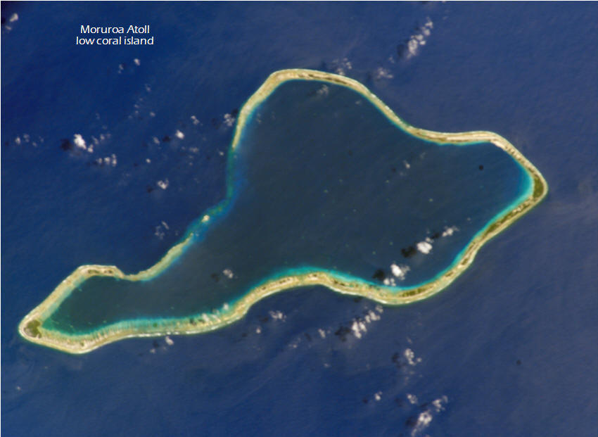
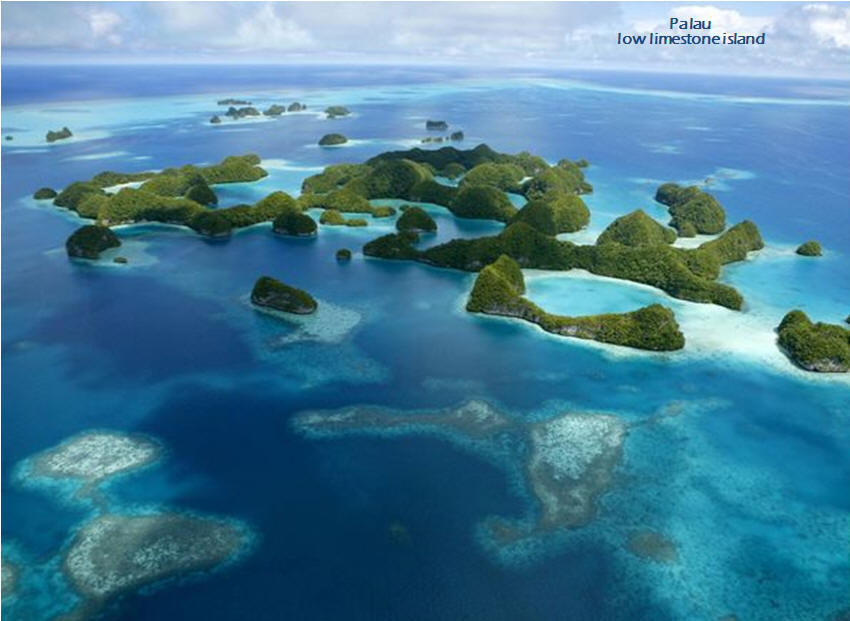 b. limestone composition: low and flat-topped, but have steep, sharp sides
since they are huge masses of rock heaved up from the sea, often surrounded
by a succession of precipitous cliffs undercut by the surf, the limestone
may be pitted and bristling with sharp pinnacles or cut by ravines or narrow
canyons, central depressions give the islands a basin-like appearance,
depression floors are commonly cut up into rolling hills, fertile and well
wooded
b. limestone composition: low and flat-topped, but have steep, sharp sides
since they are huge masses of rock heaved up from the sea, often surrounded
by a succession of precipitous cliffs undercut by the surf, the limestone
may be pitted and bristling with sharp pinnacles or cut by ravines or narrow
canyons, central depressions give the islands a basin-like appearance,
depression floors are commonly cut up into rolling hills, fertile and well
wooded
4. The two types of islands are often found in proximity to each other, especially among the islands of the South Pacific Ocean, where low islands are found on the fringing reefs that surround most high islands. Volcanic islands normally rise above a so-called hotspot.
a. The fringing reef, or shore reef, is by far the most common type of coral reef. Fringing reefs are reefs that grow directly from a shore. While there may be areas of shallow intertidal or sub-tidal sand bottom lying between the beach and the inshore edge of coral growth, there is no lagoon between the reef and shore. Without an intervening lagoon to effectively buffer freshwater runoff, pollution and sedimentation, fringing reefs tend to be particularly sensitive to these human by-products.
b. A volcanic hotspot is an area in the mantle from which heat rises as a thermal plume from deep in the Earth. High heat and lower pressure at the base of the lithosphere (tectonic plate) facilitates melting of the rock. This melt, called magma, rises through cracks and erupts to form volcanoes. As the tectonic plate moves over the stationary hot spot, the volcanoes are rafted away and new ones form in their place. This results in chains of volcanoes, such as the Hawaiian Islands.

5. Average stream discharge and stream base flow have been trending downward for nearly a century. Climate change impacts on freshwater resources in the Pacific Islands will vary across the region. Different islands will be affected by different factors, including natural variability patterns that affect storms and precipitation (like El Niño and La Niña events), as well as climate trends that are strongly influenced by specific geographic locations. For example, surface air temperature has increased and is expected to continue to rise over the entire region. On most islands, increased temperatures coupled with decreased rainfall and increased drought will reduce the amount of freshwater available for drinking and crop irrigation. Climate change impacts on freshwater resources in the region will also vary because of differing island size and topography, which affect water storage capability and susceptibility to coastal flooding. Low-lying islands will be particularly vulnerable due to their small land mass, geographic isolation, limited potable water sources and limited agricultural resources. Also, as sea level rises over time, increasing saltwater intrusion from the ocean during storms will exacerbate the situation. These are only part of a cascade of climate change related impacts that will increase the pressures on, and threats to, the social and ecosystem sustainability of these island communities.

6. Rising sea levels will escalate the threat to coastal structures and property, groundwater reservoirs, harbor operations, airports, wastewater systems, shallow coral reefs, sea grass beds, intertidal flats and mangrove forests, and other social, economic and natural resources. On low islands, critical public facilities and infrastructure as well as private commercial and residential property are especially vulnerable. Agricultural activity will also be affected, as sea level rise decreases the land area available for farming and periodic flooding increases the salinity of groundwater. Coastal and near-shore environments will progressively be affected as sea levels rise and high wave events alter low islands’ size and shape. Impacts to the built environment on low-lying portions of high islands, where nearly all airports are located and where each island’s road network is sited, will be nearly as profound as those experienced on low islands. Islands with more developed built infrastructure will experience more economic impacts from tourism loss.
7. All of the climate changes described above will have an impact on human communities in Pacific Islands. Because Pacific Islands are almost entirely dependent upon imported food, fuel and material, the vulnerability of ports and airports to extreme events, sea level rise and increasing wave heights is of great concern. In addition, sea level rise and flooding are expected to overwhelm sewer systems and threaten public sanitation.

The Pacific Islands region includes demographically, culturally and economically varied communities of diverse indigenous Pacific Islanders, intermingled with immigrants from many countries. At least 20 languages are spoken in the region. Pacific Islanders recognize the value and relevance of their cultural heritage and systems of traditional knowledge; their laws emphasize the long-term multigenerational connection with their lands and resources.
1. colonized by French, British and US
2. greatly affected by island geography and dependence on sea
3. Melanesia (black): link between Papuan and Melanesian cultures, contains many high islands because it is a major part of the Ring of Fire (string of volcanoes around the boundary of the Pacific plate and the Australian plate, a convergent plate boundary where the two plates move toward each other)
4. Micronesia (small): strong US influence, dominated by low islands
5. Polynesia (many): consistent and uniform indigenous cultures face external influences, dominated by low islands
6. cultures divided into volcanic high-island cultures and coral-based low-island cultures
a. high-island culture


i. moderate amounts of labor sufficient for comfortable survival and much time available for activities such as dancing, feasting and visiting friends and relatives
ii. the period of youth often prolonged as adults can afford to indulge their children
iii. positive attitude toward the enjoyment of leisure especially characteristic of the high islanders with their more fertile soil and more secure life
iv. live in dispersed extended-family homesteads, raised-platform houses made of volcanic rock and dirt
v. social stratification and institutions such as family, marriage, leadership, religion, etc formalized and adhered to
vi. descent traced through matrilineage
vii. land owned by extended families or lineages and individuals acquired use rights to particular plots through their kin connections, chiefs confiscate land from those out of favor and award it to loyal followers
viii. marital relationships usually rather loose and informal, although with public ceremonies and some exchange of wealth
ix. distinct social classes and chiefs supported principally by tribute from their subjects, the object of considerable deference, can punish offenses and whose principal wives generally members of other high-ranking families
x. an island might have up to four separate independent communities, each with its own leader, which sometimes fight one another
xi. interior areas not under regular cultivation considered community property and used for collecting wild food and for temporary gardens
xii. turmeric most important high-island export to low-islands
b. low-island culture

i. inhabitants of low islands culturally distinct from high islanders, though the two groups in contact with one another
ii. a belief in the stability of society and culture
iii. traditionally depended on cultivation of plant crops and on fishing in shallow reef waters
iv. live in dispersed
extended-family homesteads, raised-platform houses
made of coral rock and gravel
v. social stratification and institutions such as family, marriage, leadership, religion, etc similar to high island but only nominally and followed only informally
vi. marriage consists simply of openly living together and being spoken of by the community as spouses
vii. nominal hereditary chiefs with little special power or wealth
viii. land rights usually held through lineages or extended family groups, backed up by traditions of ancestral origins on the land and individuals acquired use rights to particular plots through their kin connections
ix. all island land owned by one or another family group, even the smallest islets with only a few coconut trees ... no community property
x. handicraft products most important low-island export to high-islands
xi. important function of inter-island trade: provide low islanders with aid and a temporary dwelling place when their islands were devastated by periodic cyclones
Harm de Blij discusses cultural differences between
the two groups of islands of the Pacific realm: low islands and high islands.
[https://youtu.be/Fd1EAxt4Kb4]
1. The population of Oceania is scattered over 30,000 islands. The low islands outnumber the high islands. High islands tend to be well-watered and have good volcanic soil. As a result, agricultural products show some diversity and life is more secure. Populations tend to be larger on these islands. Small communities cluster on low islands, and many of these have died out over time.
2. As you can see by the numbers below, the islands of Oceania have greatly reduced their population growth but because of the limited land area, density is high on some islands. Even islands with a low density may have more people than can be supported if there are few resources and little arable land. There are few actual cities in Oceania with most people living in small communities.
The Asia-Pacific Region Is Experiencing Low Fertility and Population Aging
|
|
||||||
|
9.8 |
1.9 |
48 |
19.3 |
22 |
-6,891 |
|
|
0.532 |
1.02 |
586 |
66 |
26 |
-3,210 |
|
|
0.691 |
0.8 |
221 |
42.5 |
26 |
-4,765 |
3. Keep in mind that the numbers above are sub-regional averages. Within those
averages there are wide divergences. The same is true of resources: some
islands have sufficient resources to support their populations while some don’t
even have enough arable land and water.
have sufficient resources to support their populations while some don’t
even have enough arable land and water.
4. Agriculture is more successful on high islands due to better soil conditions. Fishing is important on both low islands and high islands but it’s necessary on low islands.
1. Before colonization island communities had integrated economies among themselves. Subsistence agriculture to support local communities occurred on most of the islands. Cassava, taro, yams and sweet potatoes were the most common products of this type of agriculture.

2. Colonization severely disrupted traditional life on the islands. They were mostly governed in artificial colonial administrative groupings that disregarded historical culture and resource utilization patterns. The mosaic of political structures is a result of the region's complex colonial history and post-independence struggles. The colonizers, making the islanders dependent on imported food and goods, destroyed the subsistence economy. Also destroyed were the traditional diets, social patterns and mores ... all of which had profound implications for the economies of the region.

3. Manufactured goods are imported from Europe and the US. Geographic remoteness means that the costs of air transport and shipping profoundly influence island economies. Most islands are subsidized by colonial countries and natural resources are limited, with many communities relying on agriculture and ecosystems (such as coral reefs, open oceans, streams and forests) for sustenance and revenue. Aside from Papua New Guinea (copper and gold), New Caledonia (nickel) and Nauru (phosphate), few islands have natural resources except for a warm climate and the surrounding ocean. The islands’ lack of resources and isolated location hinder development, with a few exceptions such as Papua New Guinea.
4. The tourism industry is the unifying economic force in Oceania. Tourism contributes prominently to the gross domestic product of most island jurisdictions (as does the large US military presence). Tourism is the continent’s largest industry, measured by the number of jobs it creates and the money it spreads throughout the Pacific Islands. Tourism has had a varied history in the Pacific islands, but it has been one of the ways for the people of the region to increase their quality of life. Tourism can destroy the last remnants of traditional culture and often pays low wages to local people. Yet, it is often a better industry to work in than third world garment factories.
5. Tourism, however, can also negatively affect the economies and ecosystems of Oceania’s island nations. It can lead to overcrowding and depletion of isolated islands’ scarce resources. Tourism often focuses on fishing and other recreational water sports. The waters around many Pacific Islands, as well as parts of Australia, have been overfished. Pollution from boats and cruise ships can litter the tropical ocean, while runoff from the islands may also contain pollutants.
6. Organizations like the Oceania Sustainable Tourism Alliance aim to promote the sustainable management of natural resources, conserve biodiversity, and adapt to climate change throughout the continent. Sustainable tourism supports the development of local businesses, as opposed to global corporations such as international hotel chains, thus strengthening local and regional economies.
7. Fishing is a significant source of revenue because many islands have maritime exclusive economic zones that extend for 200 nautical miles and many small islands have granted permission to foreign countries to fish the region via fishing licenses.
8. Oceania’s political and financial future rests largely on its efforts to minimize the effects of climate change. In fact, many scientists argue that Oceania is the region most vulnerable to climate change because of its climate and geography. The predominately coastal populations of the continent’s small islands are vulnerable to flooding and erosion because of sea level rise. Fiji’s shoreline has been receding about 6 inches per year over the last 90 years, while Samoa has lost about 1.5 feet per year during that same time span. Warming temperatures have severely damaged many of Oceania’s coral reef ecosystems.
1. Historically, the political systems of Oceania varied from island to island. Political diversity ranged from several small independent tribal villages on a single island to empire-like societies whose governments and political systems ruled over several islands. The different types of environments found on each island determined population density, which greatly affected government and political organization. Isolation from neighboring islands also played a part in the political organizations of Oceania. Islands that were small in size and contained no major barriers separating one part of the island from another, tended to become a single political unit. Large islands with internal barriers tended to produce several different societies each with separate politics and organization. Large islands with no interior barriers tended to evolve into strong powers and developed a more distinct political system. Islands near each other that did not face any physical obstacles in order to communicate eventually combined to form a single political unit.
2. The European colonization of Oceania destroyed the continent’s early
political geography. Indigenous populations were treated harshly during the
colonial period. European powers claimed Oceania’s lands as their own because
they considered them terra nullius, or no man’s land inhabited by heathen
natives. Colonizers implemented their own systems of governance, land management
and trade. These efforts had severe consequences that continue to affect
indigenous groups and their cultural systems today.
3. During the Cold War, the isolated islands of Oceania became a popular location for American, British and French nuclear testing. The most famous of these experiments were carried out on Bikini Atoll, part of the Marshall Islands, beginning in 1946. These tests had devastating human and environmental impacts. Many people were forcibly removed from their island homes. People who witnessed the tests suffered from high rates of cancer. The ecosystem and habitats of the island were permanently altered. For example, the detonation of the world’s first hydrogen bomb, on Enewetak Atoll, Marshall Islands, completely vaporized the island of Elugelab. Millions of gallons of water in Elugelab’s lagoon turned to steam, and the coral reef was fractured. The last nuclear test in the region, on the island of Mururoa, French Polynesia, was conducted in 1996.
4. Oceania
a. Melanesia
Territory of New Caledonia and Dependencies (France)
Independent State of Papua New Guinea
b. Micronesia
Territory of Guam (US)
Republic of Kiribati (or Gilbert Islands)
Republic of the Marshall Islands (US)
Federated States of Micronesia (US)
Midway Atoll (US Pacific Island Wildlife Refuges)
Republic of Nauru (formerly Pleasant Island)
Commonwealth of the Northern Mariana Islands (US)
Republic of Palau (US)
Wake Island (US)
c. Polynesia
Territory of American Samoa (US)
Cook Islands (New Zealand)
Overseas Lands of French Polynesia (France)
Niue (formerly Savage Island, New Zealand)
Territory of Norfolk Island (Australia)
Pitcairn Islands (UK)
Independent State of Samoa (formerly Western Samoa)
Tokelau (New Zealand)
Territory of the Wallis and Futuna Islands (France)
Political Resources on the Net
Google's Arts & Culture collection virtual world museum tours
Pacific large ocean island states conserve huge marine areas
Fiji | A virtual vacation to the Fiji Islands | How to move a country: Fiji’s radical plan to escape rising sea levels
New Caledonia | New Caledonia is a special collectivity of France located in the southwest Pacific Ocean. The archipelago is part of the Melanesia sub region. | Photo Gallery | Journey to New Caledonia (3:40) | As coral bleaching goes global, scientists fear worst is yet to come
Papua New Guinea | The striking natural beauty and myriad complex cultures of Papua New Guinea offer some riveting and truly unique experiences.
Solomon Islands | Indigenous Solomon Islanders have their own origin stories, differing between tribes and islands but commonly indicating that they originated from within the islands rather than arriving from somewhere far away. A British protectorate since 1893, a rise in nationalist sentiment eventually led to the country's independence in 1978. The many islands that make up the Solomons are grouped into nine regions or provinces. Each region has their own provincial government and their own particular characteristics and customs. Honiara is the capital. | Solomon Islands and Sea Level Rise | The Solomon Islands: Headed for Self-destruction? | China’s mad dash into a strategic island nation breeds resentment.

In the Solomon Islands, the Salt Water (Solwata in Pidgin) people live on man-made artificial islands around Langalanga and Lau Lagoons in the Malaita Province and Duff Islands in Temotu Province. These islands are built by human hands with skills which have been handed down from one generation to the next. The largest, oldest and the most densely inhabited of such islands is Sulufou in the Lau Lagoon. There are more than 100 families and about 2000 people living there. (Use link above. Watch 3:10 video and read article that follows.)
Vanuatu | Million Dollar Point | Vanuatu Photos | Vanuatu: the Pacific island nation changing the loss and damage debate
Guam | Guam (also called "Guahan" by the natives) is one of many islands that make up Micronesia. All of Micronesia has close political ties to the US and Guam is no exception. Guam was ceded to the US by Spain in 1898 after the Spanish-American War and has remained an unincorporated territory since that time. The military installations on the island are some of the more strategically important US bases in the Western Pacific. | Guam-OnLine
Kiribati (Gilbert Islands) | In Pacific race to usher in millennium, a date-line jog | Kiribati island: Sinking into the sea? | Mauri ....This is Hello and Welcome in Kiribati. | Kiribati Aquaculture | The anomaly of Banaba Island: Part of Kiribati, but administered from Fiji | The recent Gilbertese settlement of the Line Islands | Additional oddities of Kiribati’s Line Islands
Republic of the Marshall Islands | Bikini Atoll: The birthplace of Godzilla | Marshall Islands can’t sue the world’s nuclear powers | The Marshall Islands are disappearing | About those non-disappearing Pacific islands | Life on the Marshall Islands | Cactus Dome

Federated States of Micronesia | The Federated States of Micronesia (FSM) is an independent sovereign island nation and a United States associated state consisting of four tropical island groups – from west to east, Yap, Chuuk, Pohnpei (the wettest islands in the world) and Kosrae – that are spread across the Western Pacific Ocean. Chuuk is renowned for its dramatic wreck diving, which is recognized as the best of its kind in the world. Its vast lagoon, more than 30 miles across, was Japan's 'Pearl Harbor' and more than 100 ships and aircraft were sunk while sheltering here during World War II. (The Japanese fleet rests on the lagoon floor.) This sunken fleet represents history’s largest naval loss. The warm, tropical water, prolific marine life and ocean currents have transformed these wrecks into beautiful coral gardens and artificial reefs, home to hundreds of marine animals and fish. | Government | NOAA: FSM | Asian Development Bank: FSM | Deepest part of the ocean, the Mariana Trench, proves hauntingly noisy | A country erased by global warming? (2:16)
Midway Atoll | Midway Atoll (aka Midway Island) - about 1,250 miles northwest of Honolulu - is an unorganized, unincorporated territory of the US, and is the only atoll/island in the Hawaiian archipelago not part of the State of Hawaii. Designated the Battle of Midway National Memorial in 2000, Midway Atoll National Wildlife Refuge is administered by the US Fish and Wildlife Service (FWS). As such, it is part of the Papahanaumokuakea Marine National Monument and a truly unique and fragile ecosystem. Nearly 3 million birds live on Midway so flights always arrive and depart in darkness to maximize the safety of aircraft. | Diary from the middle of nowhere | Little Island, Big History | Midway: Message from the gyre (3:54) | Midway Atoll: Paradise and the garbage patch | Midway Atoll today | For Midway Atoll’s birds, plastic is the main dish | Midway Island (3:53) (not for those with weak stomachs)

Nauru | Nauru is a small island in the South Pacific Ocean and is the world's smallest independent republic. The people of Nauru were once among the world's richest. Formerly known as Pleasant Island, Nauru supplied Australia with fertilizer for almost a century after vast phosphate deposits were discovered in 1900. By 2005, in an abrupt reversal of fortune, Nauru was a nearly failed state with an uncertain future, dependent on injections of cash from other countries to keep afloat. So what happened? When the phosphate ran out, unemployment hit 90% and the school system collapsed. Mining had stripped 80% of the country, leaving barren jagged rock entirely unsuitable for agriculture, industry, forestry or even sport and recreation. Things are tough these days. Employment is scarce, health care is basic at best and many local people have become understandably reticent in their dealings with outsiders. | A short history of Nauru, Australia’s dumping ground for refugees | NFSA Australia 1962: Nauru (20:36) | Paradise Lost 2001 (19:44) | Island Raiders ABC Four Corners 2004 (43:20)
Northern Mariana Islands | The Commonwealth of the Northern Mariana Islands (CNMI) is a crescent-shaped archipelago comprising the summits of fifteen mostly dormant volcanic mountains in the western North Pacific Ocean. It was from one tiny island, Tinian, that American B-29s flew to drop the atomic bomb on Japan. Today, the Mariana Islands can seem like a package-tour nightmare (their main source of income) but they are also made up of lovely beaches, flame trees, deer hunting, quiet nights, small farms, fiery sunsets and genuine natural beauty. | History and geography | The Pentagon wants to bomb the hell out of this tiny Pacific island | The State of the Union gets awkward when you can't vote for a president | This is the most beautiful place in America you've never heard of | Saipan, Northern Mariana Islands Cam
Palau | Photos from National Geographic | History and geography | Culture | Palau vs. the poachers | Island Times | Palau’s Jellyfish Lake | Palau from National Geographic
Wake Island | Prewar history of Wake | Photos (Scroll down for some rare photos from Wake.) | A remote coral island with a gristly history | The 98 rock | For you history buffs, the WWII Battle of Wake Island
 Polynesian Discovery (8:07):
Evidence that the Polynesians had found and were trading with the Americas
hundreds of years before Columbus. |
Polynesia, an introduction |
‘Game-changing’ study suggests first Polynesians voyaged all the way from East
Asia |
The Discovery and Settlement of Polynesia |
Native Americans and Polynesians Met Around 1200 AD
Polynesian Discovery (8:07):
Evidence that the Polynesians had found and were trading with the Americas
hundreds of years before Columbus. |
Polynesia, an introduction |
‘Game-changing’ study suggests first Polynesians voyaged all the way from East
Asia |
The Discovery and Settlement of Polynesia |
Native Americans and Polynesians Met Around 1200 AD
 American Samoa |
Fa'afafine |
American Samoa (aka Amerika Samoa) is an unincorporated territory of
the US located in the South Pacific, the southernmost territory of the US and
one of two US territories south of the equator. Due to economic hardship,
military service has been seen as an opportunity in American Samoa and it is
noted for having the highest rate of military enlistment of any US state or
territory. About
⅓
of the population works for the StarKist tuna cannery. The
Chicken of the Sea cannery closed when American Samoans were granted minimum
wage under US law. Although technically considered "unorganized," American Samoa
is self-governing under a constitution that became effective in 1967. American
Samoa is on the UN list of Non-Self-Governing Territories but the listing is
disputed by territorial government officials, who do consider themselves to be
self-governing. |
National Park of American Samoa |
iPacific South Pacific News
American Samoa |
Fa'afafine |
American Samoa (aka Amerika Samoa) is an unincorporated territory of
the US located in the South Pacific, the southernmost territory of the US and
one of two US territories south of the equator. Due to economic hardship,
military service has been seen as an opportunity in American Samoa and it is
noted for having the highest rate of military enlistment of any US state or
territory. About
⅓
of the population works for the StarKist tuna cannery. The
Chicken of the Sea cannery closed when American Samoans were granted minimum
wage under US law. Although technically considered "unorganized," American Samoa
is self-governing under a constitution that became effective in 1967. American
Samoa is on the UN list of Non-Self-Governing Territories but the listing is
disputed by territorial government officials, who do consider themselves to be
self-governing. |
National Park of American Samoa |
iPacific South Pacific News
It is now a known fact that corals are threatened by global warming. Some scientists are even predicting the end of coral life by 2050. Meanwhile, there is a mystery to solve: how some corals in American Samoa have resisted centuries of climate change to become giants and how others are thriving in waters so warm that it is normally considered deadly. The American Samoa Enigma
Cook Islands | The Cook Islands … fifteen islands across 2 million sq km of Pacific Ocean … It doesn't get much more remote. | Suwarrow Atoll: A desert island with both a buried treasure and a famous castaway | Rarotonga flycatchers, threatened Pacific birds | The islands | History and geography | Cook Islands News | Cook Islands, a Paradise of Untouchable Assets
 French Polynesia |
Photos |
Officially, the Collectivity of
French Polynesia is an overseas
collectivity of the French Republic and
its sole overseas country. It is made
up of several groups of islands:
Austral Islands, Bass Islands,
Gambier Islands,
Marquesas Islands,
Society Islands (including Tahiti) and
Tuamotu Archipelago. French Polynesia has a moderately developed
economy, which is dependent on imported goods, tourism and the financial
assistance of mainland France. |
Tahiti is the largest island in French Polynesia, and the location of the
capital city,
Papeete (5:40). Shaped like a figure-8, it's divided into Tahiti Nui (the
larger, western section) and Tahiti Iti (the eastern peninsula). |
Photos |
A Journey to the Disappointment Islands |
The Perilous Hunt for Coconut
Crabs on a Remote Polynesian Island
(Makatea, part of the Tuamotu Archipelago in French Polynesia, sits in the South
Pacific about 150 miles northeast of Tahiti.)
French Polynesia |
Photos |
Officially, the Collectivity of
French Polynesia is an overseas
collectivity of the French Republic and
its sole overseas country. It is made
up of several groups of islands:
Austral Islands, Bass Islands,
Gambier Islands,
Marquesas Islands,
Society Islands (including Tahiti) and
Tuamotu Archipelago. French Polynesia has a moderately developed
economy, which is dependent on imported goods, tourism and the financial
assistance of mainland France. |
Tahiti is the largest island in French Polynesia, and the location of the
capital city,
Papeete (5:40). Shaped like a figure-8, it's divided into Tahiti Nui (the
larger, western section) and Tahiti Iti (the eastern peninsula). |
Photos |
A Journey to the Disappointment Islands |
The Perilous Hunt for Coconut
Crabs on a Remote Polynesian Island
(Makatea, part of the Tuamotu Archipelago in French Polynesia, sits in the South
Pacific about 150 miles northeast of Tahiti.)
Niue | Government | The official website of the people of Niue | History and geography | Culture | Niue and climate change | Niue, the Pacific island struggling to cope as its population plummets | NIUETV | Niue Photo Tour | The Two-Decade Fight for Two Letters on the Internet
Norfolk Island | Norfolk Island faces fight for independence | Norfolk Island home page | 360° of History and Culture (1:58) | The Norfolk Islander | The Norfolk Island Virtual Tour
Pitcairn Islands | Immediate protection needed for Pitcairn's marine bounty | Pitcairn Islands get huge marine reserve | Take me to Pitcairn (55:24) | Tom Christian, descendant of Bounty mutineer, dies at 77 | Pitcairn News | The people of Pitcairn Islands are the direct descendants of Pitcairn's first European settlers, the HMAV Bounty mutineers, and their Polynesian consorts. | Pitcairn Islands Tourism

Samoa (formerly Western Samoa) | 1949 New Zealand production, Western Samoa, Lotus Land of the Pacific (17:06)
Tokelau | It takes upwards of 24 hours to reach Tokelau by boat from its nearest neighbor, Samoa, and you can forget about flying ... there’s no airstrip. Once you’re there, the ship that brought you is your only means of getting between the nation’s three atolls – Fakaofo, Atafu and Nukunonu. It takes nine hours to travel between the two most distant ones (Fakaofo and Atafu). Your ship is also your ticket home, so you’ll have to be prepared to stay for at least five days until it’s ready to leave, or wait for the next one in a week's time. | Tokelau is the first nation on the planet truly fueled by renewable energy.
Tonga | Two worlds of Tonga | Travel to the Royal Kingdom of Tonga (6:45), a South Pacific nation which claims never to have been colonized by a foreign power. |Tonga 2 | Tonga is an archipelago of 176 islands (approximately 52 of which are inhabited), scattered over 270,272 square miles of ocean. | Tupou VI crowned King of Kingdom of Tonga | An underwater volcano erupted near Tonga, triggering a chain of tsunami warnings across the South Pacific and for the West Coast of the US. The volcano’s eruption was dramatic, sending plumes of gas and ash thousands of feet into the atmosphere. Prime Minister Jacinda Ardern of New Zealand said there were significant signs of damage on the island nation. | A single undersea cable connects Tonga to the internet. Last week’s eruption cut the island nation off. | An ash cloud, damaged communications and risks of COVID are hampering aid to Tonga after a volcanic eruption. | See How the Tonga Volcano Unleashed a Once-in-a-Century Shockwave. | Photos capture devastation from Tonga volcano eruption
Tuvalu |
Islands in Danger |
Tuvaluan Legends |
Will we survive or will we disappear under the sea?
Wallis and Futuna | Two little-known French-funded volcanic specks lie smack in the center of the Polynesia/Melanesia region. Wallis and Futuna are linked through French governance but that’s where the connection ceases: Wallis has ancestral connections with Tonga, while Futuna traces its roots to Samoa. This is evident in the languages, which are quite different although mutually comprehensible. The two islands remain competitive with each other, but Wallis, being more populous and the center of government, retains the upper hand. The islands’ economy is limited to traditional subsistence agriculture, with about 80% of the labor force earning its livelihood from agriculture (coconuts and vegetables), livestock (mostly pigs), and fishing. French government subsidies and remittances from expatriate workers make up a sizeable portion of revenue. According to legend uninhabited Alofi (one of the smaller islands) was as densely inhabited as Futuna up until the 19th century, when the Futuna people slaughtered and ate the population in a single raid. | Culture | Royal dispute sees palace occupied in French territory | Locals cut off air access to island | Photos | Photos 2 | Wallis and Futuna | What to do in the Wallis and Futuna islands
There are lots of pictures so it may take a minute for the page to open!
![]()

1. The early Greeks suggested that there was a southern landmass. However, this remained unknown for several centuries, although Terra Incognita Australis (unknown southern land) appears as an immense but quite fanciful continent on a map published in 1531. Even 100 years ago, only small parts of Antarctica had been mapped, and there were several inaccuracies. Only recently have satellite pictures allowed us to build up a complete map of the continent.
2. The continent of Antarctica makes up most of the Antarctic region. It covers approximately 20% of the Southern Hemisphere and is the fifth-largest continent in terms of total area. (It is larger than both Oceania and Europe.)
3. Antarctica is the coldest, windiest, highest and driest of the world’s continents, and so hostile and remote that it has no permanent inhabitants. There are, however, permanent human settlements, where scientists and support staff live for part of the year on a rotating basis.
4. The nearest countries to Antarctica are South Africa, Australia, New Zealand, Chile and Argentina.
5. The oceans surrounding Antarctica provide an important physical component of the Antarctic region. The waters surrounding Antarctica are relatively deep, reaching 13,123 - 16,404 feet in depth.
6. The geographic south pole is Earth's southernmost point, at latitude 90°S, where all lines of longitude meet. The magnetic south pole shifts about 5 miles per year and is located at about 64.07°S and 135.88°E on the Adélie Coast of Antarctica (2020).

7. Antarctica, uniquely in the world, is a continent set aside by treaty purely for science.
8. Among many other types of scientists, astrobiologists (scientists who study the possibility of life outside Earth’s atmosphere) have used the Antarctic environment to study Mars. The desert conditions in Antarctica are like the conditions on Mars. NASA tested robots in Antarctica that later landed on Mars. In 1984, a meteorite from Mars was found in Antarctica. The markings on this meteorite were similar to markings left by bacteria on Earth. If this meteorite, millions of years old, actually has the remains of Martian bacteria, it would be the only scientific evidence for life outside Earth.
1. More than 180 million years ago, Antarctica, along with Africa, South America and peninsular India, was part of the supercontinent Gondwana. Over time, Gondwana gradually broke apart and Antarctica drifted to its present location centered at 90°S latitude. The ultimate separation of Australia and South America from Antarctica, about 35 million years ago, created a circumpolar current that resulted in an isolated continent. This in turn led to long-term snowfall, the preservation of glaciers and an eventual ice sheet, beginning some 14 million years ago. Like all other continents, Antarctica has at its core an ancient shield. The rocks of the East Antarctica Shield are as old as 4 billion years, which means that they are among the oldest known rocks on Earth. Geologically, west Antarctica closely resembles the Andes mountain range of South America. The only anomalous area of west Antarctica is the Ellsworth Mountains region, more similar to that of the Transantarctic Mountains and east Antarctica. This suggests that the Ellsworth Mountains must have broken away from a direct connection to the Transantarctic Mountains and rotated 90 degrees to reach their present location.

2. Without any ice, Antarctica would look like a giant peninsula and archipelago
of mountainous islands, known as Lesser Antarctica, and a single large landmass
about the size of Australia, known as Greater Antarctica. The continent itself
is depressed more than half a mile to near sea level under the tremendous load
of the ice sheet, with some regions well below sea level.
a. Lesser Antarctica, to the west, is made up of younger, volcanic and sedimentary rock. Lesser Antarctica is part of the Ring of Fire, a tectonically active area around the Pacific Ocean. Tectonic activity is the interaction of plates on Earth’s crust, often resulting in earthquakes and volcanoes. The majority of the islands and archipelagos of Lesser Antarctica are volcanic and heavily glaciated. They are also home to a number of high mountains. The Antarctic Peninsula, a mountainous region, is probably Antarctica’s most prominent geographical feature. This curved extension of the continent extends nearly 250 miles north of the Antarctic Circle and points toward the southern tip of South America. The Antarctic Peninsula has a number of glaciers and large floating ice shelves that are changing rapidly because this part of Antarctica is warming faster than the rest of the continent. It has the most moderate climate, and is one of the most rapidly warming regions on Earth. Ross Island is located off the coast of west Antarctica and is home to Mount Erebus, the southernmost active volcano on Earth. Another well-known volcano is found on Deception Island, which is famous for a giant eruption in 1970. Mount Sidley, located in the Executive Committee Range of Marie Byrd Land, is the highest volcano in Antarctica (14,058 feet). The Ross Sea is a deep bay of the Southern Ocean, located near the continent's Ross Ice Shelf.
b. Running along the length of the Antarctic peninsula, and extending across the continent is a mountain chain known as the Transantarctic Mountains. In addition to supplying spectacular views, the Transantarctics serve as a sort of dividing line across the continent, separating east and west Antarctica. Ice on the west side of this line flows west, while the opposite happens east of the divide. The Transantarctic Mountains contain some of the oldest glacial sediments in Antarctica, some of which has been there for at least 15 million years.
c. Greater Antarctica, to the east, is a high, ice-covered plateau and
the largest portion of the continent. It is composed of older, igneous and metamorphic rocks. East Antarctica is colder than west Antarctica because of its
higher elevation. Planetary scientists have found evidence of a
meteor impact much larger and earlier than the one that killed the
dinosaurs - an impact that they believe caused the biggest mass extinction in
Earth’s history. The 300-mile-wide crater lies hidden more than a mile beneath
the East Antarctic Ice Sheet. The gravity measurements that reveal its existence
suggest that it could date back about 250 million years, to the time of the
Permian-Triassic extinction, when almost all animal life on Earth died out.
Its size and location (the Wilkes Land region of east Antarctica, south of
Australia) also suggest that it could have begun the breakup of the Gondwana
supercontinent by creating the tectonic rift that pushed Australia northward.
metamorphic rocks. East Antarctica is colder than west Antarctica because of its
higher elevation. Planetary scientists have found evidence of a
meteor impact much larger and earlier than the one that killed the
dinosaurs - an impact that they believe caused the biggest mass extinction in
Earth’s history. The 300-mile-wide crater lies hidden more than a mile beneath
the East Antarctic Ice Sheet. The gravity measurements that reveal its existence
suggest that it could date back about 250 million years, to the time of the
Permian-Triassic extinction, when almost all animal life on Earth died out.
Its size and location (the Wilkes Land region of east Antarctica, south of
Australia) also suggest that it could have begun the breakup of the Gondwana
supercontinent by creating the tectonic rift that pushed Australia northward.

3. Unlike the Arctic, where floating sea ice annually melts and refreezes, Antarctica is a solid ice sheet lying on a solid continent. Antarctica is approximately 98% thick ice sheet and 2% barren rock. Its terrain is made up of glaciers, ice shelves and icebergs. According to NASA research, the sea ice in the area is incredibly thick and able to expand.
a. The Antarctic ice sheet dominates the region. It is the largest single piece of ice on Earth, containing almost 62% of all of the world's fresh water and 90% of the world’s surface fresh water. The ice sheet extends beyond the continent when snow and ice are at their most extreme. The elevation of the Antarctic ice sheet is about 6,562 feet and it reaches 13,123 feet above sea level near the center of the continent. The ice surface dramatically grows in size from about 1.2 million square miles at the end of summer to about 7.3 million square miles by winter.
b. There are actually three ice sheets in Antarctica: the East Antarctic Ice
Sheet (EAIS), the West Antarctic Ice Sheet (WAIS) and the
Antarctic Peninsula Ice Sheet. Each of these ice sheets has its own unique
characteristics and behavior. East Antarctica is grounded mostly above sea level
and forms the bulk of the Antarctic ice sheet. The EAIS is considered more
stable than the WAIS.

One reason for this is the shape and elevation of bedrock beneath the ice. Heavy masses of ice push down on bedrock, depressing areas in the central part of the ice sheet below mean sea level. If those low-lying areas happen to be near the edge of the ice sheet, which is the case in large parts of west Antarctica, then ocean water can make its way under the ice, speeding up glacier flow. This is one of the reasons that while both portions of the ice sheet are losing mass, the WAIS is losing it much faster. Recent studies of west Antarctica found that many of the large, fast-moving glaciers there are in an irreversible decline.
c. The Antarctic ice sheets are not just domes of ice spreading slowly out to their margins. They are drained by fast-flowing ice streams that drain into floating ice shelves. The Thwaites Ice Stream and Pine Island Glacier, for example, together drain 30% of the WAIS. Pine Island Glacier moves at about 33 - 32,808 feet per year, and the stability and dynamics of this ice stream are essential for the stability of the larger Antarctic ice sheet. Ice streams send branching fingers deep into the Antarctic continent and the slow-moving ice divides at the center of the different ice sheets.
d. Antarctica is fringed with ice shelves. In fact, 75% of the Antarctic continent is buttressed with ice shelves. Ice shelves are floating extensions of Antarctic glaciers, supplemented by snow falling directly onto the ice shelves and marine waters freezing below. The ice shelves collect 20% of Antarctica’s snowfall and cover 11% of its area. Ice shelves lose mass by melting from below and by calving ice bergs. In fact, basal melting from ice shelves accounts for most of the ice loss from Antarctica, and most of this ice loss comes from a few small ice shelves in west Antarctica and along the western Antarctic Peninsula. Ice sheet growth mainly occurs at the coastal ice shelves, primarily the Ross Ice Shelf and the Ronne Ice Shelf. Major ice shelves include Amery, Filchner, Larsen, Ronne and Ross.
e. If all of Antarctica’s ice were converted to liquid water, one estimate is that it would be sufficient to raise the height of the world's oceans by 190 feet.

4. Antarctica has a number of mountains, including the Transantarctic Mountains, which divide the continent into eastern and western regions. A few of these summits reach altitudes of more than 14,764 feet. The tops of mountain chains stick up through the ice. The highest elevation is Vinson Massif (16,050 feet). The lowest point is hidden in the Denman Glacier (-11,500 feet below sea level). At its surface it is the deepest ice yet discovered and the world's lowest elevation not under seawater.
5. Despite being so cold, there is water at the base of the Antarctic ice sheet in the form of sub-glacial lakes. The huge weight of the ice above melts ice at the base of the ice sheet, aided by geothermal heating. This water lubricates the base of the ice sheet, and helps the ice streams achieve their great speeds. The water ponds in lows and hollows beneath the ice sheet, and it may exist at huge hydrostatic pressure, enabling water to flow uphill. At least 379 sub-glacial lakes have been mapped so far across Antarctica, and more are being found all the time. These sub-glacial lakes influence the behavior of the ice streams of Antarctica, and the drainage of lakes may add more water to the base of an ice stream, helping it to flow faster. These lakes have been isolated from the surface for considerable periods of time and each represents a unique environment. Among them are Lake Vostok (the largest) and Lake Ellsworth.
6. The Antarctic is encompassed by the Antarctic Convergence, an uneven line of latitude where cold, northward-flowing Antarctic waters meet the warmer waters of the world’s oceans.

a. The waters surrounding Antarctica are a key part of the ocean conveyor belt, a global system in which water circulates around the globe based on density and on currents. The cold waters surrounding Antarctica, known as the Antarctic Bottom Water, are so dense that they push against the ocean floor. The Antarctic Bottom Water causes warmer waters to rise, or upwell. Antarctic upwelling is so strong that it helps move water around the entire planet. This movement is aided by strong winds that circumnavigate Antarctica. Without the aid of the oceans around Antarctica, Earth’s waters would not circulate in a balanced and efficient manner.
b. The Southern Ocean is a continuous belt of sea surrounding Antarctica. In winter, over half of the Southern Ocean freezes over. Although this seawater ice is only about 39 inches thick, it has a significant effect on ocean and atmospheric circulation. Nearly all of the sea-ice melts in summer.
c. The ocean around Antarctica is divided into several seas. Starting to
the right of the Antarctic Peninsula is the Weddell Sea, which extends to Cape
Norvegia, a small point of land jutting off of east Antarctica. Moving clockwise
around the east Antarctic coast is the Ross Sea, south of New Zealand. Next is
the Amundsen Sea, which large west Antarctic glaciers like Pine Island and
Thwaites drain into. Continuing on, we come to the Bellingshausen Sea to the
left of the Antarctic Peninsula.
d. While Antarctic land ice is shrinking, sea ice around the continent has been on the rise in recent years. During the winter, ocean water freezes, forming a layer of sea ice of roughly the same area as the Antarctic continent. Icebergs are a common sight in the waters surrounding Antarctica. These massive chunks of ice break off from glaciers and ice shelves and can be a danger to ships in the area. Sea ice is seasonal and consists of frozen sea water, together with icebergs calved from Antarctic glaciers and ice shelves. Winter sea ice around Antarctica is increasing, in contrast with winter sea ice in the Arctic, which is decreasing. This seasonal increase in sea ice may be due to colder, fresher water released from the melting ice shelves, which accumulates in a cool, fresh surface layer and shields surface waters from the warmer, deeper waters that are melting the ice shelves.
7. Antarctica has an extremely cold, dry and windy climate.
a. Winter temperatures along the coast generally range from 14° to -22°F. During the summer, coastal areas hover around 32°F but can reach temperatures as high as 48°F. In the mountainous, interior regions, temperatures are much colder, dropping below -76°F in winter and -4°F in summer. In 1983, Russia’s Vostok Research Station measured the coldest temperature ever recorded on Earth: -128.6°F. An even lower temperature was measured using satellite data taken in 2010: -135.8°F.
b. Antarctica is considered a desert because it receives very little rain or snowfall. Absolute humidity is lower than the Sahara. The small amount of snow that does fall does not melt but builds up over thousands of years to form the continent’s large, thick ice sheets. Precipitation in the Antarctic is hard to measure since it always falls as snow but Antarctica’s interior is believed to receive only 2 - 4 inches of water (in the form of snow) every year. The Antarctic desert is one of the driest deserts in the world. A persistent high pressure over the interior brings dry, subsiding air that results in very little cloud cover.
c. Antarctic winds are commonly measured at up to 200 miles per hour.
d. Antarctica has just two seasons: summer and winter. It has six
months of continuous daylight in its summer and six months of continuous
darkness in its winter.
e. The Antarctic region has an important role in global climate processes. It is an integral part of the earth-atmosphere energy balance, the relationship between the amount of solar heat absorbed by Earth’s atmosphere and the amount of heat reflected back into space. Antarctica has a larger role than most continents in maintaining Earth’s heat balance. Ice is more reflective than land or water surfaces so the massive Antarctic ice sheet reflects a large amount of solar radiation away from Earth’s surface. During summer, more solar radiation reaches the surface at the South Pole than is received at the Equator in an equivalent period. As global ice cover (ice sheets and glaciers) decreases, the reflectivity of Earth’s surface also decreases. This allows more incoming solar radiation to be absorbed by Earth’s surface, causing an unequal earth-atmosphere energy balance linked to global warming.
f. Interestingly, NASA scientists have found that climate change has actually caused more ice to form in some parts of Antarctica because of new climate patterns caused by climate change. These patterns create a strong wind pattern called the polar vortex. Polar vortex winds lower temperatures in the Antarctic and have been building in strength in recent decades - as much as 15% since 1980. This effect is not seen throughout all of the Antarctic, however, and some parts are experiencing ice melt.
8. Flora and Fauna

a. Antarctica has no grass, trees or bushes. The only plants that can survive the extreme cold are lichens, mosses and algae. The vegetation grows mainly in the northern and coastal regions, while the interior has little if any vegetation.
b. The ocean teems with fish and other marine life. In fact, the waters surrounding Antarctica are among the most diverse on the planet. Upwelling allows phytoplankton and algae to flourish. Thousands of species, such as krill, feed on the plankton. Fish and a large variety of marine mammals thrive in the cold Antarctic waters. Blue, fin, humpback, right, minke, sei and sperm whales have healthy populations in Antarctica.
c. One of the apex, or top, predators in Antarctica is the leopard seal, one of the most aggressive of all marine predators. This 9-foot, 882-pound animal has unusually long, sharp teeth, which it uses to tear into prey such as penguins and fish.
d. The most familiar animal of Antarctica is probably the penguin, which have adapted to the cold, coastal waters. Their wings serve as flippers as they fly through the water in search of prey such as squid and fish. Their feathers retain a layer of air, helping them keep warm in the freezing water.

9. Antarctica has a number of natural hazards. Changes in the weather are dramatic. A drop of 65°F was once recorded in 12 minutes. Winds can shift from calm to full-gale in a brief period of time. Katabatic (gravity-driven) winds blow coastward from the high interior. Frequent blizzards form near the foot of the plateau. Cyclonic storms form over the ocean and move clockwise along the coast. Offshore cyclones occur with little warning. Winds typically reach hurricane strength within an hour and persist for several days. A concentration of storm formation and/or intensification occurs at approximately 50°S latitude and is associated with some of the most violent seas in the world (the roaring forties). The stretch of ocean between Antarctica and the tip of South America is considered the most hostile in the world and has claimed numerous ships over the centuries. Large icebergs may calve from ice shelves. Volcanic activity occurs on Deception Island and isolated areas of west Antarctica but other seismic activity is rare and weak. Minor eruptions and lava flows are fairly common.

A Culture of Science
While the Antarctic does not have permanent human residents, the region is a busy outpost for a variety of research scientists. These scientists work at government-supported research stations and come from dozens of different countries. The number of scientists conducting research varies throughout the year, from about 1,100 in winter to around 10,000 in summer.
Researchers from a variety of scientific backgrounds study the Antarctic not only as a unique environment, but also as an indicator of broader global processes. Geographers map the surface of the world’s coldest and most isolated continent. Meteorologists study climate patterns, including the ozone hole that hovers over the Antarctic. Climatologists track the history of Earth’s climate using ice cores from Antarctica’s pristine ice sheet. Marine biologists study the behavior of whales, seals and squid. Astronomers make observations from Antarctica’s interior because it offers the clearest view of space from Earth.
Daily Life at Antarctica’s Research Stations
Antarctica has a unique culture that is best defined by daily life at its diverse research stations. Each station has its own unique design, with a variety of colors and architectural styles, including eco-friendly designs to minimize environmental impact. (You will never see abandoned or empty research stations. As part of the Antarctic Treaty, should a base close down, the country wishing to discontinue its presence is responsible for removing all structures and returning the area to its original conditions. Since this would be a financial and logistical hardship, all stations remain operational, even if it means having limited staff.)

Scientists, maintenance staff and other folks (and their families) with any number of medical conditions, including cancer and diabetes, are allowed to work in Antarctica. However, the relevant overseeing agency typically wants to confirm that any medical conditions are under enough control that they’re unlikely to pose a life-threatening situation during Antarctic residency. Per the specific requirements of the home country overseeing the research station, workers and families bound for Antarctica tend to be subject to pretty rigorous physical examinations to lessen the risk of medical issues cropping up. Even normally small medical problems can become serious in the middle of an Antarctic winter and it’s best to avoid (if possible) the associated dangers and costs of complicated medical evacuations.
On the other hand, assignment to some stations and positions requires preventative treatment for conditions that can befall a person without much warning. For example, appendicitis or a dental infection related to impacted wisdom teeth can be serious for Antarctic personnel, and some assignments require appendix and wisdom teeth removal in advance. The reasoning behind such medical requirements is made pretty clear when one considers the famous case of Leonid Rogozov. Rogozov was the only doctor on duty at Novolazarevskaya Station in Queen Maud Land during the winter of 1961, and had to extract his own appendix. He survived the harrowing self-appendectomy but neither this, nor a wisdom tooth extraction, are the sort of thing any country wants its Antarctic professionals being forced to tackle while at work in their stations. While most workers aren’t required to have their appendix or wisdom teeth removed, personnel expecting extended stays often do so voluntarily, rather than take a risk.
McMurdo Station is a US research center on the southern tip of Ross Island, a territory claimed by New Zealand. McMurdo is the largest station in Antarctica, capable of supporting 1,250 residents. Most of these residents are not scientists, but work to support station operations, construction, maintenance and daily life. McMurdo has more than 80 buildings and operates like a small city. It has a world-class laboratory and research facilities, as well as a firehouse, dormitories, stores and the continent’s only ATM.

Like all Antarctic research stations, McMurdo has a specific method of receiving necessary supplies. Once a year, cargo ships bring more than 11 million pounds of equipment and supplies, ranging from trucks and tractors, to dry and frozen foods, to scientific instruments. These cargo ships can only reach Winter Quarters Bay, McMurdo’s harbor, during summer, when the pack ice can be breached by US Coast Guard icebreakers. Additional supplies and personnel are flown in from Christchurch, New Zealand, when weather permits.
Base Esperanza, Argentina’s largest Antarctic facility, is located in
Hope Bay on the tip of the Antarctic Peninsula. The station is known for a
number of Antarctica firsts. It is the
 birthplace
of Emilio Marcos Palma, the first person to be born in Antarctica. Base
Esperanza also houses the first Catholic chapel (1976) and the first school (1978)
built on the continent. In 1979, Base Esperanza became the continent’s first
shortwave radio broadcaster, connecting the research station with Argentina’s
continental territory.
birthplace
of Emilio Marcos Palma, the first person to be born in Antarctica. Base
Esperanza also houses the first Catholic chapel (1976) and the first school (1978)
built on the continent. In 1979, Base Esperanza became the continent’s first
shortwave radio broadcaster, connecting the research station with Argentina’s
continental territory.
Davis Station is Australia’s busiest scientific research station. It is located in an ice-free area known as the Vestfold Hills. Like most research stations in Antarctica, food is very important at Davis Station.
Residents live and work closely together in facilities and outdoor environments
that are often very monotonous. As such, food plays an important role in
providing variety to residents like those at Davis Station. Food supplies are,
however, very limited. The food supply for a year at Davis Station is rationed,
per person per year. Residents live mostly on frozen and canned food. The chef
is often thought of as one of the most important people at Davis Station, making
sure to use all commodities in a way that is both creative and sustainable. Some
of the station’s most important events revolve around the chef’s creations, such
as the Midwinter Dinner, a traditional, sumptuous feast first celebrated during
the 1901-04 British Antarctic Expedition. Like many of Antarctica’s research
facilities, Davis Station has a hydroponic greenhouse, growing plants with water
and nutrients only. Hydroponics requires excellent gardeners because produce is
grown without soil. Fresh produce adds variety and nutrition to Antarctic meals.
The greenhouse also serves as a sunroom for sunlight-deprived residents,
especially during the long winter months.
Vernadsky Station was established in 1947 by the UK, which transferred ownership to Ukraine in 1996. The station is located at Marina Point on Galindez Island and boasts a lounge, called the Southernmost Bar in the World, as well as a post office where visitors may send mail from Antarctica. The station is a base for scientific research studies on long-term temperature trends that indicate global warming.
Brown Station is located in Paradise Harbor, near a gentoo penguin colony and with a lookout point 300 feet above the station. It was established in 1951 by Argentina and was developed for research programs such as biology, bacteriology, ecology, oceanography and other sciences. Throughout the years of observation, the Argentine Antarctic Institute has published more than 100 scientific papers on a variety of topics.
Located at Waterboat Point in Paradise Bay, González Videla Base was named after the Chilean President, who, in the 1940s, became the first chief of state of any nation to visit Antarctica. It’s a small station and even at the height of the summer season, there are only up to 16 people living there. Waterboat Point is an official historic site under the Antarctic Treaty and it was here that the first scientific study on penguin breeding was conducted.

Located on Half Moon Island in the South Shetland Islands and established by Argentina in 1953, Cámara Station is identifiable by its black tower with yellow stripes and is considered small, housing just up to 36 people during the summer months only. These scientists carry out observations of surface meteorology, birds and the impacts of local tourism.
Formerly known as Jubany Base, Carlini Base is an Argentinian scientific research station located on King George Island in the South Shetland Islands. This base operates year-round with a staff of up to 100 people and has laboratories for meteorology, seismography, biology, and oceanography as well as a heliport, radio station, movie theater and freezing chamber. In December 2013, rock band Metallica performed a concert at the base that was streamed worldwide.

Antarctica has no indigenous inhabitants. The first semi-permanent populations of the Antarctica region were whale hunters (mainly British and Norwegians), during a period that lasted until 1966. During that time, the population ranged from around 1000 in summer time to 200 in winter. Noted settlements were Husvik, Prince Olav Harbor, King Edward Point, Grytviken, Stromness, Ocean Harbor, Godthul and a few others.
Currently, there are both year-round and summer-only staffed research stations. A total of 55 (2023) countries operate, through their National Antarctic Program, a number of permanent seasonal-only (summer) and year-round research stations on the continent and its nearby islands south of 60°S latitude (the region covered by the Antarctic Treaty). The population engaging in and supporting science or managing and protecting the Antarctic region varies from approximately 10,000 in summer to 1,100 in winter. In addition, approximately 1,000 personnel, including ship's crew and scientists doing onboard research, are present in the waters of the treaty region.
Although the number changes from time to time, the following list is illustrative of the countries operating year-round stations.
Country
No. of Permanent
Seasonal-Only (Summer)
and Year-Round Stations,
as of 2023
Country
No. of Permanent
Seasonal-Only (Summer)
and Year-Round Stations,
as of 2023
Argentina
6
New Zealand
3
Australia
4
Norway
2
Brazil
1
Poland
1
Chile
4
Russia
5
China
3
South Africa
3
Czechia
1
South Korea
2
France
3
Ukraine
1
France & Italy jointly
1
UK
4
Germany
2
US
3
India
2
Uruguay
2
Japan
2

In addition to these permanent stations, approximately 30 (2023) field camps are established each summer to support specific projects. These seasonal-only (summer) stations, camps and refuges are operated by Argentina, Australia, Belarus, Bulgaria, Belgium, Brazil, Chile, China, Czechia, Ecuador, Finland, France, Germany, India, Italy, Japan, Netherlands, Norway, New Zealand, Peru, Poland, Russia, South Africa, South Korea, Spain, Sweden, Ukraine, UK, US and Uruguay. During the austral (Dec-Feb) summer some nations have numerous occupied locations such as tent camps, summer-long temporary facilities and mobile traverses in support of research.
Antarctica's largest urban area is McMurdo Station, operated by the US Antarctic Program, which houses approximately 1,000 people in the summer and 250 people in the winter.
The population density of Antarctica in the summer is around 0.000831481 per square mile.
 Economic Characteristics
Natural resources include iron ore, chromium, copper, gold, nickel, platinum and other minerals. Coal and hydrocarbons have been found in small noncommercial quantities. The most valuable resources of Antarctica lie offshore, namely the oil and natural gas fields found in the Ross Sea in 1973. Mineral exploitation except for scientific research is banned by the Environmental Protocol to the Antarctic Treaty. Krill, icefish, toothfish and crab have been taken by commercial fisheries, which are managed through the Commission for the Conservation of Antarctic Living Marine Resources (CCALMR).
As of 2024, Antarctica has 30 airports and 5 heliports. Most coastal stations have sparse and intermittent offshore anchorages, while a few stations have basic wharf facilities.
Continent-wide, 20% of the electricity produced in Antarctica is wind and solar egergy.
Despite its harsh weather conditions, Antarctica is a popular destination for tourists who are interested in exploring the continent's unique environment. Antarctic tourism has grown substantially in the last decade, with roughly 105,000 visitors coming to the region in the 2022-23 season. In 2009, the Antarctic Treaty Consultative Meeting (ACTM) held in New Zealand discussed the impact of tourism on the Antarctic environment. Officials worked closely with the International Association of Antarctica Tour Operators (IAATO) to establish better practices that would reduce the carbon footprint and environmental impact of tour ships. These include regulations and restrictions on the numbers of people ashore, planned activities, wildlife watching, pre- and post-visit activity reporting, passenger/crew/staff briefings, and emergency medical-evacuation plans. The ACTM and IAATO hope more sustainable tourism will reduce the environmental impacts of the sensitive Antarctic ecosystem.
Historic Issues

For many European and North American countries, Antarctica represented the last
great frontier for human exploration. Fueled by nationalist pride and supported
by advances in science and navigation, many explorers took on the Race for
the Antarctic. Explorers first skimmed the boundaries of Antarctica on sea
voyages. By the early 20th century, explorers started to traverse the interior.
The aim of these expeditions was often more competitive than scientific.
Explorers wanted to win the race to the South Pole more than to understand
Antarctica’s environment. Because early explorers confronted extreme obstacles
and debilitating conditions, this period of time became known as the Heroic
Age. Roald Amundsen, Robert Falcon Scott, Edward Adrian Wilson and Ernest
Shackleton all competed in the race to the South Pole.
In 1911, Amundsen (Norway) and Scott (UK) began expeditions with the aim of becoming the first man to reach the South Pole. Amundsen’s team set out from the Bay of Whales in the Ross Sea on October 19, while Scott set out from Ross Island on November 1. Each team used different methods, with drastically different levels of success. Amundsen’s team relied on dog sleds and skiing to reach the pole, covering as much as 40 miles per day. Scott’s team, on the other hand, pulled their sleighs by hand, collecting geological samples along the way. Amundsen’s team became the first to reach the South Pole on December 15. The team was healthy, and successfully made the journey out of Antarctica. Scott’s team reached the South Pole on January 17, 1912, suffering from malnutrition, snow blindness, exhaustion and injury. They all died on the journey home.
Hoping to one-up his predecessors, Shackleton (UK) attempted the first transcontinental crossing of Antarctica in 1914. Shackleton planned the trip by using two ships, the Aurora and the Endurance, at opposite ends of the continent. The Aurora would sail to the Ross Sea and deposit supplies. On the opposite side, the Endurance would sail through the Weddell Sea to reach the continent. Once there, the team would travel to the pole with dog teams, dispose of extra baggage, and use supplies left by the Aurora to reach the other end of the continent. The plan failed. The Endurance became frozen in the pack ice of the Weddell Sea. The pack ice crushed and sunk the ship. Shackleton’s team survived for roughly four months on the ice by setting up makeshift camps. Their food sources were leopard seals, fish and, ultimately, their sled dogs. Once the ice floe broke, expedition members used lifeboats to reach safer land and were picked up on Elephant Island 22 months after they’d set out on their journey. Although some of the crew sustained injuries, they all survived.
The journey of the Endurance expedition symbolizes the Heroic Age, a time of extreme sacrifice and bravery in the name of exploration and discovery. Apsley George Benet Cherry-Garrard, a polar explorer, summed up the Heroic Age in his book The Worst Journey in the World: "For a joint scientific and geographical piece of organization, give me Scott; for a Winter Journey, Wilson; for a dash to the Pole and nothing else, Amundsen: and if I am in the devil of a hole and want to get out of it, give me Shackleton every time.”
Contemporary Issues

Following WWII, the continent experienced an upsurge in scientific research, a time of drastic change in the Antarctic. This change was initially fueled by the Cold War, a period of time defined by the division between the US and the Soviet Union, and the threat of nuclear war. The International Geophysical Year (IGY) of 1957-58 aimed to end Cold War divisions among the scientific community by promoting global scientific exchange. The IGY prompted an intense period of scientific research in the Antarctic. Many countries conducted their first Antarctic explorations and constructed the first research stations on Antarctica. More than 50 Antarctic stations were established for the IGY by just 12 countries: Argentina, Australia, Belgium, Chile, France, Japan, New Zealand, Norway, South Africa, the Soviet Union, the UK and the US.
In 1959, these countries signed the
Antarctic Treaty, which established
that the region south of 60°S latitude remain politically neutral, no nation or
group of people can claim any part of the Antarctic as territory, countries
cannot use the region for military purposes or to dispose of radioactive waste,
and research can only be done for peaceful purposes. There are no countries in
Antarctica but there are island territories within the Antarctic Convergence
with defined claims made prior to 1959, including South Orkney Islands and South
Shetland Islands (UK), South Georgia and the South Sandwich Islands
(administered by the UK and claimed by Argentina), Peter I Island and Bouvet
Island (Norway), Heard and McDonald islands (Australia), and Scott Island and
the Balleny Islands (New Zealand). While the treaty does not legally recognize
any claims, it does support the territorial claims made before 1959. Under the
treaty, the size of these claims cannot be changed and new claims cannot be
made. Most importantly, the treaty establishes that any treaty-country has free
access to the whole region. As such, research stations supported by a variety of
treaty-countries have been constructed within each of these territorial claims.
Currently, 56 countries (2023) have signed the treaty.
The Antarctic Treaty was an important geopolitical milestone because it was the first arms control agreement established during the Cold War. Along with the IGY, the Antarctic Treaty symbolized global understanding and exchange during a period of intense division and secrecy. Many important documents have been added to the Antarctic Treaty. Collectively known as the Antarctic Treaty System, they cover such topics as pollution, conservation of animals and marine life, and protection of natural resources. The yearly Antarctic Treaty Consultative Meeting (ATCM) is a forum for the Antarctic Treaty System and its administration. Only 29 of the 56 treaty-countries have decision-making powers during these meetings (the Consultative Powers), though the other 27 are allowed to attend. These include the 12 original signatories of the Antarctic Treaty, along with 17 other countries that have conducted substantial and consistent scientific research there. The Antarctic Treaty also has Special Antarctic Treaty Consultative Meetings (SATCM), which are generally held to deal with more important topics but are less frequent, and Meetings of Experts to address specific subjects.

Two important and related issues that concern the Antarctic region are climate change and tourism. The ATCM has addressed both issues. The Antarctic has become a symbol of climate change. Scientists and policymakers are focusing on changes in this environmentally sensitive region to push for its protection and the sustainable use of its scientific resources. Climate change disproportionately affects the Antarctic region, as evidenced by reductions in the size of the Antarctic ice sheet and the warming waters off the coast. The ACTM recommended that treaty-countries develop energy-efficient practices to reduce the carbon footprint of activities in Antarctica and cut fossil fuel use from research stations, vessels, ground transportation and aircraft. But a 2023 research report from an Australian team found that the pollution left by international research stations were equal to some of the busiest ports in the world.

Beyond Penguins and Polar Bears: Mapping the Polar Regions | US Antarctic Program: McMurdo Station Webcam | Interactive Antarctic Atlas | Physical Geography of Antarctica (6:22) | Antarctic Factsheet by the British Antarctic Survey | Mapping Territorial Claims in Antarctica | Antarctic Sciences - USNSF | McMurdo Station | Amundsen-Scott South Pole Station | Palmer Station | Research on the Antarctic Region | AntarcticGlaciers.org | Maps of Antarctica | Discovering Antarctica | Antarctic and Southern Ocean Coalition | US Antarctic Program Photo Library | Antarctic Dispatches | The Bizarre Marine Creatures of Antarctica | Penguins and krill are among array of wildlife threatened by warming waters and industrial fishing. | Rumbles, booms and growls: Listen to the first recordings of these Antarctic whale calls. | The Icy Village Where You Must Remove Your Appendix | Isolated for six months, scientists in Antarctica began to develop their own accent. | How aircraft conquered Antarctica | A frozen graveyard: The sad tales of Antarctica’s deaths | Why East Antarctica is a 'sleeping giant' of sea level rise
There are lots of pictures so it may take a minute for the page to open!
![]()
|
|


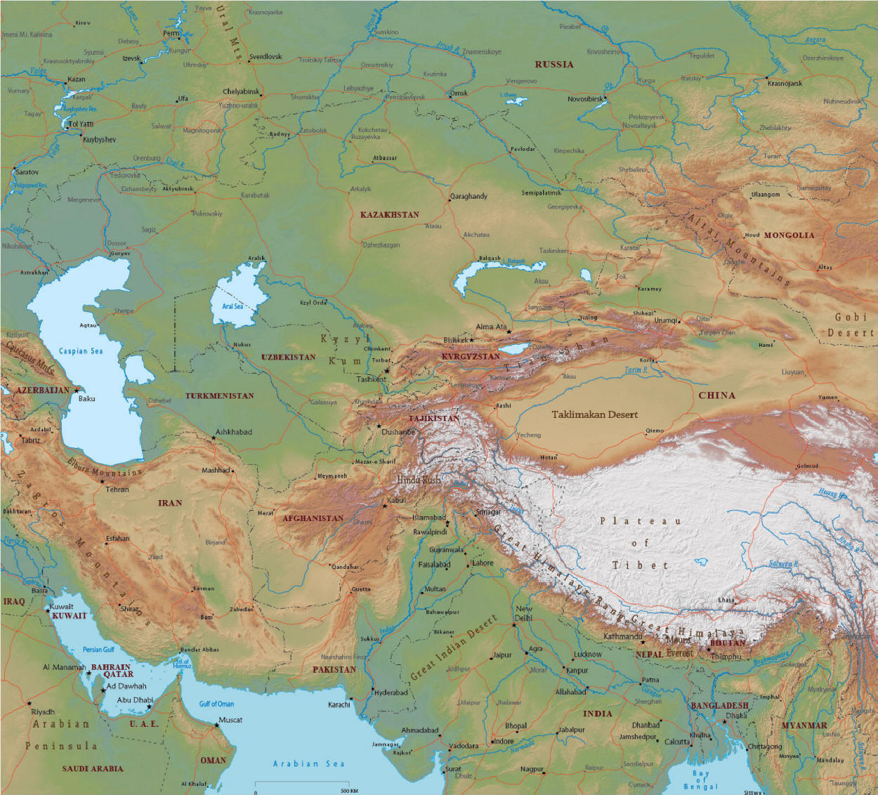


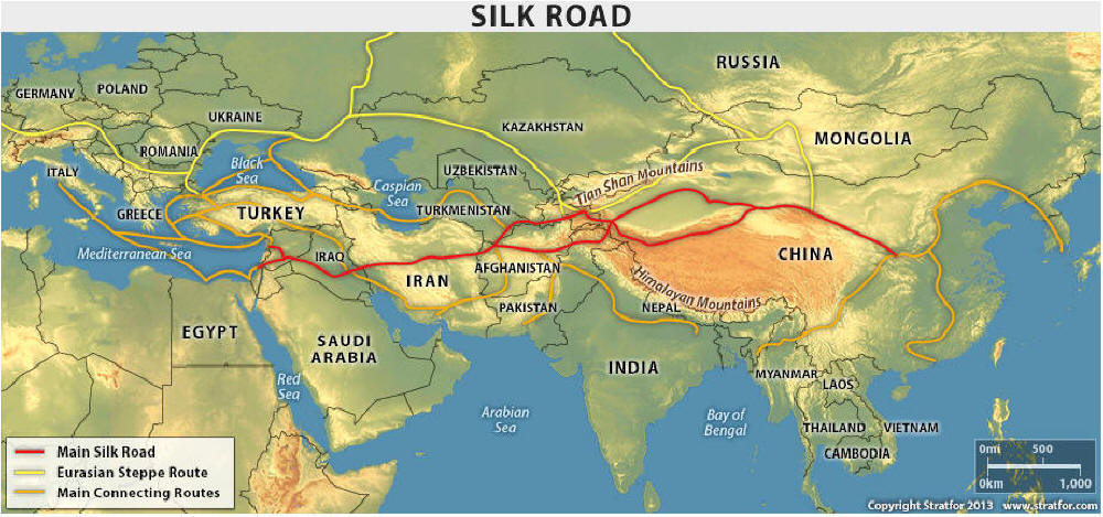


 For example, despite being home to 6,500 glaciers and around 2,000 lakes,
Kyrgyzstan still faces water shortages due to the poor maintenance of its Soviet
era plumbing and water supply systems. In addition, the rural population is
greater than the urban population and they are highly dependent on
water-intensive activities like agriculture.
For example, despite being home to 6,500 glaciers and around 2,000 lakes,
Kyrgyzstan still faces water shortages due to the poor maintenance of its Soviet
era plumbing and water supply systems. In addition, the rural population is
greater than the urban population and they are highly dependent on
water-intensive activities like agriculture.


 By far the most mysterious and unexplored of Central Asia’s 'stans,